Tathong Channel
Channels of Hong KongEastern District, Hong KongHong Kong geography stubsSai Kung DistrictSouthern District, Hong Kong

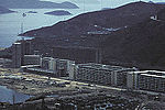
Tathong Channel (Chinese: 大東門), also known as Nam Tong Hoi Hap (藍塘海峽, originally 南堂海峽), refers to the eastern sea water area in Hong Kong leading into Victoria Harbour through Lei Yue Mun, bounded by Junk Island (Fat Tong Chau) and Tung Lung Chau in the east, and Hong Kong Island in the west.
Excerpt from the Wikipedia article Tathong Channel (License: CC BY-SA 3.0, Authors, Images).Tathong Channel
Sai Kung District Fat Tong O
Geographical coordinates (GPS) Address Nearby Places Show on map
 Continue reading on Wikipedia
 Geographical coordinates (GPS)
| Latitude | Longitude |
|---|---|
| N 22.261666666667 ° | E 114.26638888889 ° |
Address
鐵篸洲 Tit Cham Chau
Sai Kung District, Fat Tong O
Hong Kong, China
Open on Google Maps