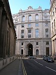
Throgmorton Street
London road stubsStreets in the City of LondonUse British English from September 2017

Throgmorton Street is a minor road in the City of London between Lothbury in the west and Old Broad Street to the east.
Excerpt from the Wikipedia article Throgmorton Street (License: CC BY-SA 3.0, Authors, Images).Throgmorton Street
Throgmorton Street, City of London
Geographical coordinates (GPS) Address Website Nearby Places Show on map
Geographical coordinates (GPS)
| Latitude | Longitude |
|---|---|
| N 51.51483 ° | E -0.08674 ° |
Address
Le Relais de Venise
Throgmorton Street 5
EC2N 2AD City of London
England, United Kingdom
Open on Google Maps


