Derby Canal

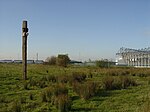
The Derby Canal ran 14 miles (23 km) from the Trent and Mersey Canal at Swarkestone to Derby and Little Eaton, and to the Erewash Canal at Sandiacre, in Derbyshire, England. The canal was authorised by an Act of Parliament in 1793 and was fully completed in 1796. It featured a level crossing of the River Derwent in the centre of Derby. An early tramroad, known as the Little Eaton Gangway, linked Little Eaton to coal mines at Denby. The canal's main cargo was coal, and it was relatively successful until the arrival of the railways in 1840. It gradually declined, with the gangway closing in 1908 and the Little Eaton Branch in 1935. Early attempts at restoration were thwarted by the closure of the whole canal in 1964. Since 1994, there has been an active campaign for restoration spearheaded by the Derby and Sandiacre Canal Trust and Society. Loss of the Derwent crossing due to development has resulted in an innovative engineering solution called the Derby Arm being proposed, as a way of transferring boats across the river.
Excerpt from the Wikipedia article Derby Canal (License: CC BY-SA 3.0, Authors, Images).Derby Canal
London Road, Derby Crewton
Geographical coordinates (GPS) Address Nearby Places Show on map
Geographical coordinates (GPS)
| Latitude | Longitude |
|---|---|
| N 52.9034 ° | E -1.4459 ° |
Address
Wickes
London Road 806
DE24 8WA Derby, Crewton
England, United Kingdom
Open on Google Maps


