place

Long Hill, Groton, Connecticut

Census-designated places in ConnecticutCensus-designated places in New London County, ConnecticutGroton, ConnecticutNeighborhoods in ConnecticutUse mdy dates from July 2023
New London County Connecticut Incorporated and Unincorporated areas Long Hill Highlighted 2010

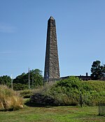
Long Hill is a census-designated place (CDP) in the town of Groton in New London County, Connecticut, United States. The population was 4,205 at the 2010 census.

Excerpt from the Wikipedia article Long Hill, Groton, Connecticut (License: CC BY-SA 3.0, Authors, Images).

Long Hill, Groton, Connecticut
Wayne Road,

Geographical coordinates (GPS) Address Nearby Places
placeShow on map

Wikipedia: Long Hill, Groton, ConnecticutContinue reading on Wikipedia

Geographical coordinates (GPS)

Latitude Longitude
N 41.354444444444 ° E -72.056666666667 °
placeShow on map

Address

Wayne Road 85
06340
United States
mapOpen on Google Maps

New London County Connecticut Incorporated and Unincorporated areas Long Hill Highlighted 2010
Share experience

Nearby Places

Battle of Groton Heights

The Battle of Groton Heights (also known as the Battle of Fort Griswold, and occasionally called the Fort Griswold massacre) was a battle of the American Revolutionary War fought on September 6, 1781 between a small Connecticut militia force led by Lieutenant Colonel William Ledyard and the more numerous British forces led by Brigadier General Benedict Arnold and Lieutenant Colonel Edmund Eyre. Lieutenant General Sir Henry Clinton ordered Arnold to raid the port of New London, Connecticut, in an unsuccessful attempt to divert General George Washington from marching against Lord Cornwallis's army in Virginia. The raid was a success, but the Connecticut militia stubbornly resisted British attempts to capture Fort Griswold across the Thames River in Groton, Connecticut. New London was burned along with several ships, but many more ships escaped upriver. Several leaders of the attacking British force were killed or seriously wounded, but the British eventually breached the fort. As the British entered the fort the Americans surrendered, but the British continued firing and killed many of the defenders. However, the high number of British casualties in the overall expedition against Groton and New London led to criticism of Arnold by some of his superiors. The battle was the last major military encounter of the war in the northern United States, preceding and being overshadowed by the decisive Franco-American siege of Yorktown about six weeks later.

Groton Bank Historic District

The Groton Bank Historic District, commonly known as Groton Heights, is a primarily residential 50-acre (20 ha) historic district in the City of Groton (within the Town of Groton) in Connecticut. The district was added to the National Register of Historic Places on March 24, 1983.The district has an inverted U-shape formed by Thames, Broad, and Monument Streets, and its boundaries are based on an 1868 map to include an area developed mostly during 1820–1860, reflecting a period of growth when Groton was a significant whaling and shipbuilding center. Groton was settled by English colonists in the mid-17th century, but it has few remaining colonial-era structures, since many were destroyed during the Battle of Groton Heights in the American Revolutionary War. A number of post-independence 18th-century houses survive, including the Major Noyes Barber house, built in 1810, which is a Federal style structure.The district contains a cross-section of architectural styles from its periods of growth. The Groton Heights Baptist Church was built in 1878 and is an example of Italianate architecture, and the Thomas Miner House on Monument Street, built about 1894, is an example of Queen Anne architecture. Non-residential buildings in the district include a number of late 19th-century commercial blocks on Thames Street, as well as the Bill Memorial Library, a high-style example of Richardsonian Romanesque design by Stephen C. Earle.