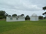
Modbury Heights, South Australia
Modbury Heights is a medium-sized suburb in the City of Tea Tree Gully, Adelaide. The suburb is located in the foothills of the Mount Lofty Ranges around 16 kilometres north east of the Central business district. Much of the suburb is residential but there is a small shopping area along Ladywood Road. The suburb is bounded by Grenfell Road to the north, Milne Road to the south, Mcintyre Road to the west, Golden Grove Road to the east and is literally cut in half by Ladywood Road. Modbury Heights is also bounded to the north and north west by the suburb of Wynn Vale, to the north east by Surrey Downs, to the east by Fairview Park, to the south by Modbury North, to the west by Para Hills and to the south east by Redwood Park.
Excerpt from the Wikipedia article Modbury Heights, South Australia (License: CC BY-SA 3.0, Authors).Modbury Heights, South Australia
Tresauget Street, Adelaide Modbury Heights
Geographical coordinates (GPS) Address Nearby Places Show on map
Geographical coordinates (GPS)
| Latitude | Longitude |
|---|---|
| N -34.811 ° | E 138.686 ° |
Address
The Heights School
Tresauget Street
5092 Adelaide, Modbury Heights
South Australia, Australia
Open on Google Maps


