place

Moorpark, California

1983 establishments in CaliforniaCities in Ventura County, CaliforniaIncorporated cities and towns in CaliforniaMoorpark, CaliforniaPopulated places established in 1983
Use mdy dates from November 2023
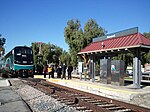
Moorpark Metrolink
Moorpark Metrolink

Moorpark is a city in Ventura County in Southern California. Moorpark was founded in 1900. The town grew from just over 4,000 citizens in 1980 to over 25,000 by 1990. As of 2006, Moorpark was one of the fastest-growing cities in Ventura County. The population was 34,421 at the 2010 census, up from 31,415 at the 2000 census.

Excerpt from the Wikipedia article Moorpark, California (License: CC BY-SA 3.0, Authors, Images).

Moorpark, California
Flinn Avenue,

Geographical coordinates (GPS) Address Nearby Places
placeShow on map

Wikipedia: Moorpark, CaliforniaContinue reading on Wikipedia

Geographical coordinates (GPS)

Latitude Longitude
N 34.281111111111 ° E -118.87361111111 °
placeShow on map

Address

Flinn Avenue
93021
California, United States
mapOpen on Google Maps

Moorpark Metrolink
Moorpark Metrolink
Share experience

Nearby Places

Moorpark station
Moorpark station

Moorpark station is a passenger rail station in the city of Moorpark, California. Service commenced in 1983 as an infill station on the short-lived CalTrain line. The station was rebuilt in 1992 to accommodate the new Metrolink Ventura County Line commuter trains. Service on that line began on October 26, 1992; Amtrak's Santa Barbara–San Diego San Diegan trains had begun stopping there the day before.Amtrak's Pacific Surfliner from San Luis Obispo to San Diego and Metrolink's Ventura County Line from Los Angeles Union Station to East Ventura stop here. Moorpark station is served by ten Amtrak Pacific Surfliner trains (five in each direction) every day, with departures evenly spaced throughout the day. Sixteen Metrolink Ventura County Line trains (eight in each direction) serve the station each weekday, running during peak hours in the peak direction of travel. On weekends, four Metrolink Ventura County Line trains (two in each direction) serve the station. Metrolink passengers also have access to all Pacific Surfliner trains through a codesharing arrangement with Amtrak.Moorpark served as the Ventura County Line's terminal until service was extended to Oxnard after the Northridge earthquake in 1994, and now acts as the western terminus of the Ventura County Line except during peak hours in the peak direction of travel. Metrolink stores trains in a small yard a short distance west of the station.In FY2018, boarding or detraining Amtrak passengers averaged approximately 50 passengers daily.

Santa Rosa Valley, California

Santa Rosa Valley is a rural unincorporated community, named after the eponymous valley in which it lies, located in Ventura County, California, United States. For statistical purposes, the United States Census Bureau has defined Santa Rosa Valley as a census-designated place (CDP). The census definition of the area may not precisely correspond to local understanding of the area with the same name. The 2010 United States census reported Santa Rosa Valley's population was 3,334. Santa Rosa Valley sits at an elevation of 433 feet (132 m).It lies within the County of Ventura north of Newbury Park, between Thousand Oaks and Camarillo. Norwegian Grade, which was constructed by the Norwegian Colony, connects Santa Rosa Valley to Thousand Oaks, while it may be reached from Santa Rosa Road in Camarillo. The Santa Rosa Valley lies right north of the Conejo Valley and along the Arroyo Santa Rosa and Arroyo Conejo. Most of the area consists of agricultural lands and it is home to a variety of wildlife such as bobcats, gray foxes, mule deer, coyotes, and more. The valley is likely the habitat for more than one Mountain lion, and lions are relatively often observed here. Immediately to the south is the Conejo Canyons Open Space, with trails leading to the Arroyo Conejo Nature Preserve (La Branca) and Hill Canyon, and the community also borders Mount Clef Ridge and Wildwood Regional Park to the south.Santa Rosa Valley was home to a Chumash village in pre-colonial times, known as Šumpaši, which was located by Conejo Creek.

Mount Clef Ridge
Mount Clef Ridge

Mount Clef Ridge is a 1,076 ft volcanic mountain in Thousand Oaks, California. It is a volcanic outcrop that resulted from lava eruptions 30 million years ago. The ridge was formerly under ownership by the Janss Corporation, but was acquired by the Conejo Recreation and Park District (CRPD) in 1967. Trails here are available from Santa Rosa Valley, Newbury Park and Wildwood Regional Park. Although being a major feature of Wildwood, it occupies its own open-space area bordering Wildwood's northern boundaries. Mount Clef Ridge Open Space Area occupies 212 acres. From the ridge are great panoramic views of Santa Rosa Valley, Conejo Valley, Hill Canyon, as well as the Santa Susana-, Santa Monica- and Topatopa Mountains. The open-space area is home to plants such as coastal sage scrub, chaparral, Lyon's pentachaeta and Conejo dudleya. The fauna includes mountain lions, deer, coyotes, gray foxes, and more.Mount Clef Ridge was featured in the film Flaming Star (1960) starring Elvis Presley. The horse training scenes in Dark Victory (1939) starring Ronald Reagan also features sequences by the ridge. An army was storming off Mount Clef Ridge in the film Spartacus (1960). The ridge was also featured in Wuthering Heights (1939), where the ridge dubbed for Peniston Crag, England.A rock shelter, known as Wildflower Cave (Ven-486), is located here and was utilized for shelter by the Chumash people in pre-colonial times.The ridge is named in honor of the California Lutheran Education Foundation (CLEF), which worked to establish California Lutheran University in the 1950s.The ridgeline extends from the Norwegian Grade westwards to Wildwood Regional Park. A rock formation that spells out "CLU" can be found atop Mount Clef on the campus of California Lutheran University, and a 30-foot cross is located just east of the landmark letters. The cross was made from old telephone poles. This part of the ridge, Dr. Rudy Edmund Living Laboratory, was dedicated on May 5, 2003, in order to enhance student research in biology and geology at the university. Ecological field studies also take place here. The area's namesake, CLU professor Rudy Edmund, published extensively on the need to preserve Mount Clef Ridge.