place

Wisborough Green

Villages in West Sussex
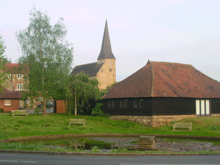
WG Pond
WG Pond

Wisborough Green is a village and civil parish in the north of the Chichester district of West Sussex, England, 2 miles (3.2 km) west of Billingshurst on the A272 road. Newbridge, where the A272 crosses the River Arun 1 mile (1.6 km) east of the village, was the highest point of the Arun Navigation, and the southern end of the Wey and Arun Canal. Newbridge Wharf(e), beneath the bridge, was an important part of the local transport system in the nineteenth century, before which, in the parish much further south, Pallingham Quay or Wharf was the limit of most navigation.

Excerpt from the Wikipedia article Wisborough Green (License: CC BY-SA 3.0, Authors, Images).

Wisborough Green
Petworth Road, Chichester Wisborough Green

Geographical coordinates (GPS) Address Nearby Places
placeShow on map

Wikipedia: Wisborough GreenContinue reading on Wikipedia

Geographical coordinates (GPS)

Latitude Longitude
N 51.023 ° E -0.505 °
placeShow on map

Address

Petworth Road

Petworth Road
RH14 0DY Chichester, Wisborough Green
England, United Kingdom
mapOpen on Google Maps

WG Pond
WG Pond
Share experience

Nearby Places

Adversane
Adversane

Adversane is a large hamlet in the Horsham District of West Sussex, England, located 1.5 miles south of Billingshurst (where, at the 2011 Census, the population was included). It consists of a cluster of houses and a public house (the Blacksmith's Arms, now 10/10 Restaurant) at a crossroads on the A29 road, on the Roman road named Stane Street. Adversane means the hyrne (corner) of the estate of Hadfold and was first documented as Hadesfoldesberne in 1279. The hamlet was known as Hadfoldshern until the 1850s. The Blacksmith's Arms stands beside the site of the blacksmiths shop, where Gaius (George) Carley was the last of many smiths to work the forge until it closed in the 1960s. He lived at Grigg's Cottage, a half-timbered cottage opposite. Stane Street cottages, opposite the pub, were probably built using the Roman road as their foundation, as the road deviates slightly at this point, returning to its straight line a little distance further on, and the sandstone houses are precisely in line with both sections of Stane Street. They are in fact a single building, converted in the 1930s from a malt warehouse built by the Allen brothers of Horsham, whose activities are described in A History of Horsham, published by Horsham Museum. They were maltsters who smuggled malt from the continent during the Napoleonic wars and hid their contraband in secret cellars under this and several other warehouses in the Horsham area. The cellars had a tendency to flood and were filled in during the 1950s.