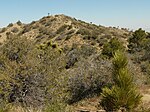
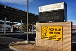
Joshua Tree, California
Census-designated places in CaliforniaCensus-designated places in San Bernardino County, CaliforniaPopulated places in the Mojave DesertUse mdy dates from July 2023

Joshua Tree is a census-designated place (CDP) in San Bernardino County, California, United States. The population was 7,414 at the 2010 census. At approximately 2,700 feet (820 meters) above sea level, Joshua Tree and its surrounding communities are located in the High Desert of California. The center of the business district in Joshua Tree is on California State Route 62.
Excerpt from the Wikipedia article Joshua Tree, California (License: CC BY-SA 3.0, Authors, Images).Joshua Tree, California
29 Palms Highway,
Geographical coordinates (GPS) Address Nearby Places Show on map
Geographical coordinates (GPS)
| Latitude | Longitude |
|---|---|
| N 34.134722222222 ° | E -116.31166666667 ° |
Address
Safari Motor Inn
29 Palms Highway 61959
92252
California, United States
Open on Google Maps


