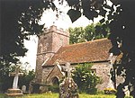
Warmwell
Dorset geography stubsVillages in Dorset

Warmwell is a small village and civil parish in south west Dorset, England, situated on the B3390 road about 5 miles (8.0 km) southeast of Dorchester. In 2013 the estimated population of the parish was 80.Warmwell contains several historic buildings, including a Jacobean manor house, and from May 1937 was the home of RAF Station Woodsford airfield (later renamed RAF Warmwell), which is now a popular holiday site and contains a caravan park and several other small businesses.
Excerpt from the Wikipedia article Warmwell (License: CC BY-SA 3.0, Authors, Images).Warmwell
Kingfisher Lakes,
Geographical coordinates (GPS) Address Website Nearby Places Show on map
Geographical coordinates (GPS)
| Latitude | Longitude |
|---|---|
| N 50.6904 ° | E -2.3409 ° |
Address
Warmwell Holiday Park
Kingfisher Lakes
DT2 8JE , Crossways
England, United Kingdom
Open on Google Maps


