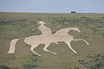
Broadmayne

Broadmayne is a village in the English county of Dorset. It lies two miles south-east of the county town Dorchester. The A352 main road between Dorchester (from Sherborne) and Wareham passes through the village. In the 2001 Census the population of the village was 1,864, reducing to 1,204 at the 2011 Census. There is an electoral ward of the same name whose population at the above census was 1,870. Village facilities and services include a post office, a clinic (closed since 2014) and a public house (The Black Dog). There are two churches in the village, both of which were redesigned by Thomas Hardy, who was an architect before he became a novelist. The parish church of St Martin dates from the 13th century and has a notable south tower.
Excerpt from the Wikipedia article Broadmayne (License: CC BY-SA 3.0, Authors, Images).Broadmayne
Cowleaze Road,
Geographical coordinates (GPS) Address Nearby Places Show on map
Geographical coordinates (GPS)
| Latitude | Longitude |
|---|---|
| N 50.6774 ° | E -2.3828 ° |
Address
Cowleaze Road
DT2 8EW , Broadmayne
England, United Kingdom
Open on Google Maps


