Schauenberg
Castles in the canton of ZürichRuined castles in SwitzerlandSwiss castle stubs

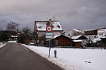
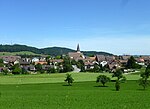
Schauenberg is a hill and ruined castle near Turbenthal, canton of Zurich, at 892 m (2,927 ft) elevation. There were fortifications since the Iron Age, and since the early 13th century, there was a wooden structure, in the 1250s extended to a massive keep. The fortress was destroyed in 1344. From 1622, Zurich maintained a system of beacons as a warning system, and signals from Schauenberg could be seen at Schnabel (Albis), Pfannenstiel, Tämbrig (above Hermatswil), Uetliberg, Lägern, Zürichberg, Mörsburg, Kyburg, Stammheimerberg and even Hohenklingen.
Excerpt from the Wikipedia article Schauenberg (License: CC BY-SA 3.0, Authors, Images).Schauenberg
Talbachstrasse,
Geographical coordinates (GPS) Address Nearby Places Show on map
Geographical coordinates (GPS)
| Latitude | Longitude |
|---|---|
| N 47.46 ° | E 8.8661111111111 ° |
Address
Talbachstrasse
8488
Zurich, Switzerland
Open on Google Maps


