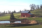
Pollock Pines, California
1936 establishments in CaliforniaCensus-designated places in CaliforniaCensus-designated places in El Dorado County, CaliforniaPopulated places established in 1936Populated places in the Sierra Nevada (United States)

Pollock Pines is a census-designated place (CDP) in El Dorado County, California, United States. It is part of the Sacramento–Arden-Arcade–Roseville Metropolitan Statistical Area. Pollock Pines lies at an elevation of 3,980 feet (1,210 m) in the Sierra Nevada. The population was 6,871 at the 2010 census, up from 4,728 at the 2000 census.
Excerpt from the Wikipedia article Pollock Pines, California (License: CC BY-SA 3.0, Authors, Images).Pollock Pines, California
Laurel Drive,
Geographical coordinates (GPS) Address Nearby Places Show on map
Geographical coordinates (GPS)
| Latitude | Longitude |
|---|---|
| N 38.761388888889 ° | E -120.58666666667 ° |
Address
Laurel Drive 2964
95726
California, United States
Open on Google Maps


