King Fire
2014 California wildfiresWildfires in El Dorado County, California

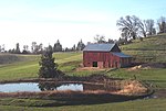
The King Fire was a wildfire that scorched over 97,000 acres (390 km2) of land in El Dorado County, California in the fall of 2014. The fire, which was named because it started off King of the Mountain Road in Pollock Pines, started on September 13, 2014 near Pollock Pines, California, to the east of Sacramento.
Excerpt from the Wikipedia article King Fire (License: CC BY-SA 3.0, Authors, Images).King Fire
Flatlander Lane,
Geographical coordinates (GPS) Address Nearby Places Show on map
Geographical coordinates (GPS)
| Latitude | Longitude |
|---|---|
| N 38.782 ° | E -120.604 ° |
Address
Flatlander Lane 1902
95726
California, United States
Open on Google Maps


