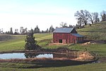
Sly Park, California
AC with 0 elementsEl Dorado County, California geography stubsUnincorporated communities in CaliforniaUnincorporated communities in El Dorado County, California

Sly Park (formerly, Park) is an unincorporated community in El Dorado County, California. It is located in Sly Valley 13 miles (21 km) east of Placerville, at an elevation of 3560 feet (1085 m).A post office operated at Sly Park from 1891 to 1919, with several moves. The name honors James Sly, one of the Mormons who discovered Sly Valley.
Excerpt from the Wikipedia article Sly Park, California (License: CC BY-SA 3.0, Authors, Images).Sly Park, California
Bucktail Lane,
Geographical coordinates (GPS) Address Nearby Places Show on map
Geographical coordinates (GPS)
| Latitude | Longitude |
|---|---|
| N 38.721388888889 ° | E -120.58472222222 ° |
Address
Bucktail Lane 6263
95726
California, United States
Open on Google Maps


