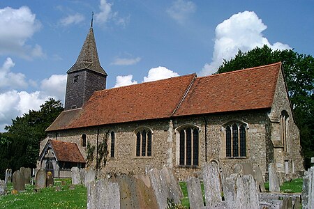
Kemsing
Civil parishes in KentSevenoaks DistrictVillages in Kent

Kemsing is a village and civil parish in the Sevenoaks district of Kent, England. The parish lies on the scarp face of the North Downs, 20 miles south east of Central London, 4 miles (6 km) north east of Sevenoaks. Also in the parish are the hamlets of Heaverham, 1 mile (2 km) to the east, and Noah's Ark 0.5 miles (1 km) to the south. The population of the civil parish in 2001 was 4014 persons, increasing to a population of 4,218 at the 2011 Census.
Excerpt from the Wikipedia article Kemsing (License: CC BY-SA 3.0, Authors, Images).Kemsing
The Landway,
Geographical coordinates (GPS) Address Nearby Places Show on map
Geographical coordinates (GPS)
| Latitude | Longitude |
|---|---|
| N 51.30712 ° | E 0.22518 ° |
Address
The Landway
The Landway
TN15 6TG , Kemsing
England, United Kingdom
Open on Google Maps


