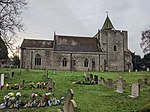
Hollingbourne
Borough of MaidstoneCivil parishes in KentUse British English from June 2016Villages in Kent

Hollingbourne is a village and civil parish in the borough of Maidstone in Kent, England. The parish is located on the southward slope of the North Downs to the east of the county town, Maidstone. The parish population is around 900 and has three conservation areas: Upper Street in the village centre and the outlying hamlets of Broad Street and Eyhorne Street.
Excerpt from the Wikipedia article Hollingbourne (License: CC BY-SA 3.0, Authors, Images).Hollingbourne
Upper Street,
Geographical coordinates (GPS) Address Nearby Places Show on map
Geographical coordinates (GPS)
| Latitude | Longitude |
|---|---|
| N 51.267 ° | E 0.642 ° |
Address
Upper Street
Upper Street
ME17 1UH , Hollingbourne
England, United Kingdom
Open on Google Maps


