place

Mosquera, Cundinamarca

Municipalities of Cundinamarca DepartmentPopulated places established in 1861Populated places of the Muisca Confederation
Parque mosquera
Parque mosquera

Mosquera is a municipality of Colombia in the Western Savanna Province, part of the department of Cundinamarca. Mosquera is close to the capital Bogotá and is part of its metropolitan area. The urban centre of Mosquera is situated at an altitude of 2,516 metres (8,255 ft) on the Bogotá savanna. The municipality borders the localities Bosa and Fontibón of Bogotá in the east, Soacha in the south, Madrid and Funza in the north and Bojacá in the west.

Excerpt from the Wikipedia article Mosquera, Cundinamarca (License: CC BY-SA 3.0, Authors, Images).

Mosquera, Cundinamarca
Calle 3,

Geographical coordinates (GPS) Address Nearby Places
placeShow on map

Wikipedia: Mosquera, CundinamarcaContinue reading on Wikipedia

Geographical coordinates (GPS)

Latitude Longitude
N 4.7077777777778 ° E -74.232777777778 °
placeShow on map

Address

Calle 3

Calle 3
250040
Colombia
mapOpen on Google Maps

Parque mosquera
Parque mosquera
Share experience

Nearby Places

Bacatá
Bacatá

Bacatá (Chibcha: Muyquytá or Muequetá) is the name given to the main settlement of the Muisca Confederation on the Bogotá savanna. It mostly refers to an area, rather than an individual village, although the name is also found in texts referring to the modern settlement of Funza, in the centre of the savanna. Bacatá was the main seat of the zipa, the ruler of the Bogotá savanna and adjacent areas. The name of the Colombian capital, Bogotá, is derived from Bacatá, but founded as Santafe de Bogotá in the western foothills of the Eastern Hills in a different location than the original settlement Bacatá, west of the Bogotá River, eventually named after Bacatá as well. The word is a combination of the Chibcha words bac, ca and tá, and means "(enclosure) outside the farmfields", referring to the rich agricultural lands of the Sabana Formation on the Bogotá savanna. Bacatá was submitted to the Spanish Empire by the conquistadors led by Gonzalo Jiménez de Quesada on April 20, 1537. Santafe de Bogotá, the capital of the New Kingdom of Granada, was formally founded on August 6, 1538. The last zipa of an independent Bacatá was Tisquesusa, who died after being stabbed by a Spanish soldier. His brother, Sagipa, succeeded him and served as last zipa under Spanish rule. The name Bacatá is maintained in the highest skyscraper of Colombia, BD Bacatá, and in the important fossil find in the Bogotá Formation; Etayoa bacatensis.

Bogotá savanna
Bogotá savanna

The Bogotá savanna is a montane savanna, located in the southwestern part of the Altiplano Cundiboyacense in the center of Colombia. The Bogotá savanna has an extent of 4,251.6 square kilometres (1,641.6 sq mi) and an average altitude of 2,650 metres (8,690 ft). The savanna is situated in the Eastern Ranges of the Colombian Andes. The Bogotá savanna is crossed from northeast to southwest by the 375 kilometres (233 mi) long Bogotá River, which at the southwestern edge of the plateau forms the Tequendama Falls (Salto del Tequendama). Other rivers, such as the Subachoque, Bojacá, Fucha, Soacha and Tunjuelo Rivers, tributaries of the Bogotá River, form smaller valleys with very fertile soils dedicated to agriculture and cattle-breeding. Before the Spanish conquest of the Bogotá savanna, the area was inhabited by the indigenous Muisca, who formed a loose confederation of various caciques, named the Muisca Confederation. The Bogotá savanna, known as Muyquytá, was ruled by the zipa. The people specialised in agriculture, the mining of emeralds, trade and especially the extraction of rock salt from rocks in Zipaquirá, Nemocón, Tausa and other areas on the Bogotá savanna. The salt extraction, a task exclusively of the Muisca women, gave the Muisca the name "The Salt People". In April 1536, a group of around 800 conquistadors left the relative safety of the Caribbean coastal city of Santa Marta to start a strenuous expedition up the Magdalena River, the main fluvial artery of Colombia. Word got around among the Spanish colonisers that deep in the unknown Andes, a rich area with an advanced civilisation must exist. These tales bore the -not so much- legend of El Dorado; the city or man of gold. The Muisca, skilled goldworkers, held a ritual in Lake Guatavita where the new zipa would cover himself in gold dust and jump from a raft into the cold waters of the 3,000 metres (9,800 ft) high lake to the northeast of the Bogotá savanna. After a journey of almost a year, where the Spanish lost over 80% of their soldiers, the conquistadors following the Suárez River, reached the Bogotá savanna in March 1537. The zipa who ruled the Bogotá savanna at the arrival of the Spanish was Tisquesusa. The Muisca posed little resistance to the Spanish strangers and Tisquesusa was defeated in April 1537 in Funza, in the centre of the savanna. He fled towards the western hills and died of his wounds in Facatativá, on the southwestern edge of the Bogotá savanna. The Spanish conquistador Gonzalo Jiménez de Quesada established the New Kingdom of Granada with capital Santa Fe de Bogotá on August 6, 1538. This started a process of colonisation, evangelisation and submittance of the Muisca to the new rule. Between 65 and 80% of the indigenous people perished due to European diseases as smallpox and typhus. The Spanish introduced new crops, replacing many of the New World crops that the Muisca cultivated. 
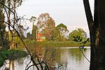
Over the course of the 16th to early 20th century, the Bogotá savanna was sparsely populated and industrialised. The rise in population during the twentieth century and the expansion of agriculture and urbanisation reduced the biodiversity and natural habitat of the Bogotá savanna severely. Today, the Metropolitan Area of Bogotá on the Bogotá savanna hosts more than ten million people. Bogotá is the biggest city worldwide at altitudes above 2,500 metres (8,200 ft). The many rivers on the savanna are highly contaminated and efforts to solve the environmental problems are conducted in the 21st century.

El Dorado International Airport

El Dorado International Airport (IATA: BOG, ICAO: SKBO) is an international airport serving Bogotá, Colombia and its surrounding areas. The airport is located mostly in the Fontibón district of Bogotá, although it partially extends into the Engativá district and the municipality of Funza in the Western Savanna Province of the Cundinamarca Department. It served over 35 million passengers in 2019 and 740,000 metric tons of cargo in 2018, making it the second busiest airport in South America in terms of passenger traffic and the busiest in terms of cargo traffic. El Dorado is also by far the busiest and most important airport in Colombia, accounting for just under half (49%) of the country's air traffic.El Dorado is a hub for the Colombian flag-carrier Avianca and subsidiaries Avianca Express and Avianca Cargo; LATAM Colombia; Satena; Wingo; and a number of other cargo airlines. It is owned by the Government of Colombia and operated by Operadora Aeroportuaria Internacional (OPAIN), a consortium composed of Colombian construction and engineering firms, and the Swiss company Flughafen Zürich AG, the company that operates Zurich Airport. The airport has been named the best airport in South America by World Airport Awards. El Dorado received four-star certification from and its staff was rated the best in South America by Skytrax, as well as achieving 42nd place in Skytrax's World's Top 100 Airports in 2017.