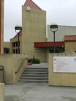
Lake Chabot Regional Park
Alameda County, California geography stubsBerkeley HillsEast Bay Regional Park DistrictGeography of San Leandro, CaliforniaParks in Alameda County, California ... and 2 more
Parks in Oakland, CaliforniaParks in the San Francisco Bay Area

Lake Chabot Regional Park is a regional park located in the southern Berkeley Hills in Alameda County, California. It is part of the East Bay Regional Parks system. Lake Chabot is a reservoir located in the park. The northern part of the lake and park lie within the boundary of the City of Oakland, while the southern part lies in an unincorporated area of Alameda County adjacent to Castro Valley and San Leandro. The dam and reservoir's water are part of the East Bay Municipal Utility District (EBMUD) water system.
Excerpt from the Wikipedia article Lake Chabot Regional Park (License: CC BY-SA 3.0, Authors, Images).Lake Chabot Regional Park
Lost Ridge,
Geographical coordinates (GPS) Address Nearby Places Show on map
Geographical coordinates (GPS)
| Latitude | Longitude |
|---|---|
| N 37.739769 ° | E -122.101364 ° |
Address
Lost Ridge
Lost Ridge
94577
California, United States
Open on Google Maps


