Anthony Chabot Regional Park
Bay Area Ridge TrailBerkeley HillsEast Bay Regional Park DistrictParks in Alameda County, California

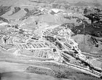
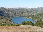
Anthony Chabot Regional Park is a regional park in Oakland, Alameda County, California in the United States. It is part of the East Bay Regional Park District system, and covers 5,067 acres (2,051 ha) in the San Leandro Hills adjacent to Oakland, San Leandro and Castro Valley. Popular activities include hiking, cycling and horseback riding. A gun range operated by the Chabot Gun Club was shut down in 2016, following complaints about pollution. The terrain of the park is often steep, consisting of grasslands, chaparral, and eucalyptus groves.
Excerpt from the Wikipedia article Anthony Chabot Regional Park (License: CC BY-SA 3.0, Authors, Images).Anthony Chabot Regional Park
Grass Valley Trail,
Geographical coordinates (GPS) Address Nearby Places Show on map
Geographical coordinates (GPS)
| Latitude | Longitude |
|---|---|
| N 37.766 ° | E -122.119 ° |
Address
Grass Valley Trail
Grass Valley Trail
94577
California, United States
Open on Google Maps


