place

Clemence–Irons House

1691 establishments in Rhode IslandBuildings and structures in Johnston, Rhode IslandHistoric American Buildings Survey in Rhode IslandHistoric New EnglandHistoric house museums in Rhode Island
History of New EnglandHouses completed in 1691Houses in Providence County, Rhode IslandHouses on the National Register of Historic Places in Rhode IslandMuseums in Providence County, Rhode Island
Clemence Irons House Johnston, Rhode Island

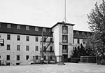
The Clemence–Irons House (also known as the Edward Manton House) is a historic house located in Johnston, Rhode Island. It was built by Richard Clemence in 1691 and is a rare surviving example of a "stone ender", a building type first developed in the western part of England and common in colonial Rhode Island. The house is listed on the National Register of Historic Places, and is a historic house museum owned and operated by Historic New England. It is open Saturdays between June and mid-October.

Excerpt from the Wikipedia article Clemence–Irons House (License: CC BY-SA 3.0, Authors, Images).

Clemence–Irons House
Greenville Avenue,

Geographical coordinates (GPS) Address Nearby Places
placeShow on map

Wikipedia: Clemence–Irons HouseContinue reading on Wikipedia

Geographical coordinates (GPS)

Latitude Longitude
N 41.839166666667 ° E -71.484444444444 °
placeShow on map

Address

Greenville Avenue 269
02919
Rhode Island, United States
mapOpen on Google Maps

Clemence Irons House Johnston, Rhode Island
Share experience

Nearby Places

Manton, Providence, Rhode Island

Manton is a residential neighborhood in Providence, Rhode Island and part of Johnston, Rhode Island. It is in the westernmost part of the city. of Providence The town of North Providence borders it to the north, Johnston to the west, while the neighborhoods of Hartford, Olneyville, and Mount Pleasant border it inside Providence. Separating it from other Providence neighborhoods to its east are Rushmore Ave, Chalkstone Ave, Smith Street, and the Triggs Memorial Golf Course. The Woonasquatucket River separates it from Johnston to the west. Throughout the 17th and 18th centuries, Manton remained a rural agrarian region. The eponymous Edward Manton was one of the original land owners, whose family would accumulate a huge tract of land. Toward the late 18th and early 19th centuries, the proximity of the Woonasquatucket River was responsible for the establishment of a few tanneries in Manton and neighboring Olneyville. The rural location of Manton made it ideal for the establishment of vacation homes. A stagecoach inn was one of the earliest places to take summer vacations. In 1835, the hotel was converted to a school. In 1862, the school was demolished to make way for present-day Rhode Island College. Taking advantage of the water power provided by the Woonasquatucket River, early industrialists established mills, the first two being constructed in 1827 and 1830. Railroad lines running east through Olneyville to Downtown facilitated the rapid development of the area, which was heavily industrial by the end of the 19th century. The closure of the textile mills and collapse of heavy industry encouraged the exodus of working class residents to the suburbs. A public housing project, Manton Heights, was built in 1953, and may have contributed to the white flight. During the 1970s, Manton lost 15 percent of its population. By the 1980s, Manton Heights had, like so many public housing complexes, fallen into disrepair. The Manton-Fruit Hill Neighborhood Association was founded about this time and encourages neighborhood participation and improvement.