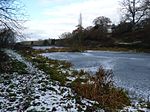
Worfield
Civil parishes in ShropshireEngvarB from October 2013Golf clubs and courses in ShropshireOpenDomesdayVillages in Shropshire

Worfield is a village and civil parish in Shropshire in the West Midlands, England. It is 120 miles (190 km) northwest of London and 10 miles (16 km) west of Wolverhampton. It is north of Bridgnorth and southeast of Telford. The parish, which includes the hamlet of Chesterton, is an extensive one which lies on the River Worfe. The name Worfield comes from its location on the river Worfe and the surrounding countryside (fields). The manor of Worfield is mentioned in Domesday Book, where it formed part of the Seisdon Hundred of Staffordshire and was held by Hugh of Montgomery, 2nd Earl of Shrewsbury.
Excerpt from the Wikipedia article Worfield (License: CC BY-SA 3.0, Authors, Images).Worfield
Main Street,
Geographical coordinates (GPS) Address Phone number Website Nearby Places Show on map
Geographical coordinates (GPS)
| Latitude | Longitude |
|---|---|
| N 52.558 ° | E -2.357 ° |
Address
Worfield Endowed CE Primary School
Main Street
WV15 5LF , Worfield
England, United Kingdom
Open on Google Maps


