place

Cowlyd Tramway

2 ft gauge railways in WalesRailway lines closed in 1968Railway lines opened in 1917TrefriwUse British English from January 2018
Vague or ambiguous time from October 2016
Cowlyd tramway route

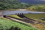
The Cowlyd Tramway was a 2 ft (610 mm) narrow gauge railway line used to convey men and materials to Llyn Cowlyd Reservoir, near Trefriw in northern Wales during the enlargement of the dam, and thereafter for maintenance purposes.

Excerpt from the Wikipedia article Cowlyd Tramway (License: CC BY-SA 3.0, Authors, Images).

Cowlyd Tramway
Pont Brwynog,

Geographical coordinates (GPS) Address Nearby Places
placeShow on map

Wikipedia: Cowlyd TramwayContinue reading on Wikipedia

Geographical coordinates (GPS)

Latitude Longitude
N 53.15601 ° E -3.88669 °
placeShow on map

Address

Pont Brwynog
LL27 0JZ , Dolgarrog
Wales, United Kingdom
mapOpen on Google Maps

Cowlyd tramway route
Share experience

Nearby Places

Llyn Crafnant
Llyn Crafnant

Llyn Crafnant is a lake that lies in a valley in Wales where the northern edge of the Gwydir Forest meets the lower slopes of the Carneddau mountains and, more specifically, the ridge of Cefn Cyfarwydd. The head of the valley offers a profile of crags which are silhouetted at sunset. The Forest Park guide (2002) states that "the (view along Llyn Crafnant) is one of the most breathtaking views in all Snowdonia". The summits include Crimpiau 475 metres (1,558 feet), and Craig Wen 548 metres (1,798 feet) which provide views to Moel Siabod and the Ogwen Valley, and Snowdon. Further up is Creigiau Gleision. At 63 acres (250,000 m2) it is the best part of a mile long, although it was clearly once much longer - its southern end shows the evidence of centuries of silting. Jehu's survey (see references) recorded a maximum depth of 71 ft (22 m). Crafnant takes its name from “craf”, an old Welsh word for garlic, and “nant”, a stream or valley. The lake can be reached by car only from Trefriw in the Conwy valley, though many visitors walk there from the village or from the neighbouring lake of Llyn Geirionydd, which runs parallel to it, but a mile distant, the two being separated by Mynydd Deulyn – “mountain of the two lakes”. The lake can also be reached on foot from Capel Curig. There is a Natural Resources Wales car park with toilets, which is reached just before the lake itself, and the lakeside cafe (open from Easter until late summer) offers car parking for patrons. The lake is a popular fishing spot, and is kept stocked with brown trout and rainbow trout. From the cafe, it is possible to hire boats for fishing or for pleasure. Private boating and swimming are not permitted. The lake is a reservoir and was dammed at its northern end in 1874, but the dam itself is barely visible as the outflow plunges down steeply from it. By the outflow is an obelisk, erected in 1896 by the inhabitants of Llanrwst which commemorates "the gift to that town of this lake with 19 acres (77,000 m2) of land" by Richard James. The lake is leased to the owners of what is now the cafe. In the upper part of the valley there is no mains water connection and during the particularly dry summer of 2006 many properties were without water. The River Crafnant ("Afon Crafnant" in Welsh) joins the River Conwy at Trefriw, but not before some of it has been diverted to pass through the Trefriw Woollen Mills to generate hydro-electricity for the machinery. Cornel, a large property in 25 acres (10 ha) on the southern banks of the lake, is owned and operated by the Welsh Scout Council. Areas around the lake have been used for location shots in Hollyoaks, Tomb Raider II, the 1981 fantasy movie Dragonslayer, and the lake also appeared briefly in the 1966 film Morgan: A Suitable Case for Treatment.

Llyn Cowlyd
Llyn Cowlyd

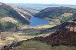
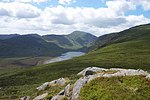
Llyn Cowlyd is the deepest lake in northern Wales. It lies in the Snowdonia National Park at the upper end of Cwm Cowlyd on the south-eastern edge of the Carneddau range of mountains, at a height of 1,164 feet (355 m) above sea level. The lake is long and narrow, measuring nearly 2 miles (3 km) long and about a third of a mile (500 m) wide, and covers an area of 269 acres (1.1 km2). It has a mean depth of 109 feet (33 m) and at its deepest has given soundings of 229 feet (70 m), this being some 45 ft (14 m) greater than its natural depth, the water surface having been raised twice by the building of dams.The surrounding hills drop steeply to the water's edge, from Cefn Cyfarwydd and Creigiau Gleision to the east, and Pen Llithrig y Wrach to the west, and as a consequence have not been forested in the 20th century, as were the slopes of neighbouring Llyn Crafnant. Indeed, there is not a tree to be seen, and the general aspect is one of bleakness. Dependent on the weather conditions, the waters often appear dark. The supply of water to Llyn Cowlyd is assisted at its south-western end by a leat which runs roughly east–west along the 1370-foot contour to the south and west of the lake, along the Llugwy valley. It is also fed by water from Llyn Eigiau. Llyn Cowlyd can be reached by road from Trefriw, some 3 miles (5 km) to the east, although the metalled road stops at a gate, the best part of a mile from the lake itself, beyond which private vehicles are not permitted. Llyn Cowlyd can also be reached by foot from Capel Curig, some 2 miles (3 km) away, from the ridge of Cefn Cyfarwydd, or from above Dolgarrog. A good path runs along the north-western shore of the lake. The stream which flows from Llyn Cowlyd is called Afon Ddu. This flows into the river Conwy, passing Pont Dolgarrog on the B5106 road, just south of the village of Dolgarrog. The gorge cut by the river at this point is popular for gorge walking.