Howdendyke
East Riding of Yorkshire geography stubsUse British English from December 2014Villages in the East Riding of Yorkshire

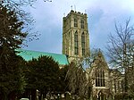
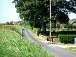
Howdendyke is a hamlet in the East Riding of Yorkshire, England. It is situated approximately 2 miles (3.2 km) north of Goole town centre and about 1 mile (1.6 km) south of Howden. Howdendyke forms part of the civil parish of Kilpin. It lies on the north bank of the River Ouse and has port facilities run by PD Ports.
Excerpt from the Wikipedia article Howdendyke (License: CC BY-SA 3.0, Authors, Images).Howdendyke
Tutty Row,
Geographical coordinates (GPS) Address Nearby Places Show on map
Geographical coordinates (GPS)
| Latitude | Longitude |
|---|---|
| N 53.733446 ° | E -0.857519 ° |
Address
Tutty Row
DN14 7UQ
England, United Kingdom
Open on Google Maps


