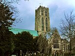
Howden
Civil parishes in the East Riding of YorkshireHowdenMarket towns in the East Riding of YorkshireOpenDomesdayTowns in the East Riding of Yorkshire ... and 1 more
Use British English from December 2015

Howden () is a market and minster town and civil parish in the East Riding of Yorkshire, England. It lies in the Vale of York to the north of the M62, on the A614 road about 16 miles (26 km) south-east of York and 3 miles (4.8 km) north of Goole, which lies across the River Ouse. William the Conqueror gave the town to the Bishops of Durham in 1080. The wapentake of Howdenshire was named after the town, and remained an exclave of County Durham until as late as 1846. The original boundaries of the wapentake were used for the current two government wards of Howden and Howdenshire, which had a combined population of 19,753 at the 2011 census.
Excerpt from the Wikipedia article Howden (License: CC BY-SA 3.0, Authors, Images).Howden
Geographical coordinates (GPS) Address Nearby Places Show on map
Geographical coordinates (GPS)
| Latitude | Longitude |
|---|---|
| N 53.744111 ° | E -0.863416 ° |
Address
DN14 7GS
England, United Kingdom
Open on Google Maps


