place

Ardsley, Pennsylvania

Unincorporated communities in Montgomery County, PennsylvaniaUnincorporated communities in PennsylvaniaUse mdy dates from July 2023
Ardsley PA Battle of Edge Hill

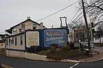
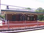
Ardsley is an unincorporated community located in Abington Township, as well as Upper Dublin Township, Montgomery County, Pennsylvania, United States. It is a neighbor of Glenside. A large portion of this neighborhood is composed of the historic cemeteries Hillside Cemetery and Ardsley Burial Park. It is the location of the Ardsley SEPTA station. On December 7, 1777, the Battle of Edge Hill was fought in the area. British forces attacked American troops posted on Edge Hill, which runs from southwest to northeast along the present-day Willow Grove Avenue and Edge Hill Road. Near where Limekiln Pike crosses Edge Hill, British and Hessian light infantry routed a force of Pennsylvania militia and the 2nd Connecticut Regiment led by Joseph Reed. Farther to the northeast on Edge Hill, riflemen and Maryland militia commanded by Daniel Morgan put up a tougher fight before falling back to join the main army at Camp Hill and Fort Washington.In 2001, the area was heavily damaged by Tropical Storm Allison. A township project was undertaken to stop future flooding. This project included the re-creation of a drainage basin known locally as "Floaties Pond", which has worked well in that not much more flooding has occurred.

Excerpt from the Wikipedia article Ardsley, Pennsylvania (License: CC BY-SA 3.0, Authors, Images).

Ardsley, Pennsylvania
Cricket Avenue,

Geographical coordinates (GPS) Address Nearby Places
placeShow on map

Wikipedia: Ardsley, PennsylvaniaContinue reading on Wikipedia

Geographical coordinates (GPS)

Latitude Longitude
N 40.121111111111 ° E -75.155277777778 °
placeShow on map

Address

Cricket Avenue 752
19038
Pennsylvania, United States
mapOpen on Google Maps

Ardsley PA Battle of Edge Hill
Share experience

Nearby Places

Pennsylvania's 13th congressional district

The 13th congressional district of Pennsylvania is a congressional district in the U.S. state of Pennsylvania. The district contains all of Adams, Bedford, Blair, Cambria, Franklin, Fulton, Huntingdon, Juniata, Mifflin, and Perry counties. It also includes slivers of Cumberland and Somerset counties. Republican John Joyce has represented the district since 2019. With a Cook Partisan Voting Index rating of R+25, it is the most Republican district in Pennsylvania.Prior to February 2018, the district was located in southeastern Pennsylvania, covering eastern Montgomery County and Northeast Philadelphia. The district traditionally included most of Montgomery County, but was redrawn in 2002 to include part of Philadelphia, and altered again in 2012. The Supreme Court of Pennsylvania redrew the district in February 2018 after ruling the previous map unconstitutional. The old 13th district became the 4th district, and what was the ninth district in the southwest part of the state was modified and redesignated the 13th district, for the 2018 elections and representation thereafter.The previously drawn district had long been a Republican stronghold, like many suburban districts in the Northeast. However, the brand of Republicanism in southeastern Pennsylvania was a moderate one, and the district, like the Philadelphia suburbs as a whole, became friendlier to Democrats during the 1990s as the national party veered to the right. The district had not voted Republican for President since 1988. In 1992, the district elected its first Democratic representative in 86 years, Marjorie Margolies-Mezvinsky. She was defeated in 1994 by Republican Jon D. Fox, but Joe Hoeffel regained the seat for the Democrats in 1998. It was in Democratic hands afterward, becoming even more Democratic after being pushed into Philadelphia after the 2000 census. In 2018, it was redistricted again by court order, becoming the most Republican congressional district in the Northeast.

Fitzwatertown, Pennsylvania

Fitzwatertown is an unincorporated community located in Montgomery County, Pennsylvania, in the United States. The community is in Upper Dublin Township, 2.13 miles (3.43 km) south of Jarrettown, 2.5 miles (4.0 km) west of Abington, 1 mile (1.6 km) northeast of Oreland and approximately 12.3 miles (19.8 km) north of Philadelphia. Fitzwatertown is located at the intersection of Limekiln Pike, Fitzwatertown Road and Jenkintown Road. Bean's 1884 History of Montgomery County, Pennsylvania describes Fitzwatertown as follows: Fitzwatertown is situated in the southern part of the township, on the Limekiln turnpike, in the midst of the fertile valley of Sandy Run, abounding in limestone and iron-ore. This is an old settlement where Thomas Fitzwater followed lime-burning before the summer of 1705 and had a grist-mill erected at an early period. It contains a store hotel, wheel-wright and blacksmith-shop, grist-mill and about twelve house. The post-office was established here before 1858. The value of lime produced in Upper Dublin for 1840 was stated to be twenty thousand two hundred and seventy-five dollars, which was all produced in this vicinity, but the business has since been greatly increased through railroad facilities. Edge Hill Station, of the North Pennsylvania Railroad, is only a mile distant; yet, with all its surpassing advantages, as may be observed, has made but very little progress for the last half-century. The grist-mill mentioned was long carried on by John Price and is now, owned by Samuel Conard. Sandy Run is a steady stream rising at the Moreland line, about three miles distant.