Øvre Romerike
Akershus geography stubsDistricts of Viken

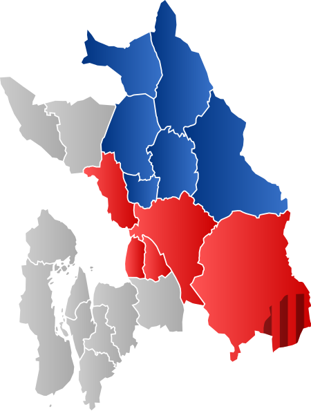
Øvre Romerike is the upper (northern) half of the traditional Norwegian district Romerike. It consists of the Akershus municipalities Gjerdrum, Nannestad, Eidsvoll, Hurdal, Ullensaker and Nes. The lower (southern) portion is known as Nedre Romerike.
Excerpt from the Wikipedia article Øvre Romerike (License: CC BY-SA 3.0, Authors, Images).Øvre Romerike
Predel, Elsteraue
Geographical coordinates (GPS) Address Nearby Places Show on map
Geographical coordinates (GPS)
| Latitude | Longitude |
|---|---|
| N 60.1496 ° | E 11.019 ° |
Address
Dorfgemeinschaftshaus
Predel
06729 Elsteraue
Sachsen-Anhalt, Deutschland
Open on Google Maps


