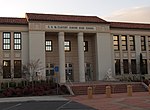
City College station (Sacramento)

City College station is an at-grade light rail station on the Blue Line of the Sacramento RT Light Rail system operated by the Sacramento Regional Transit District. The station is located in an exclusive right-of-way alongside the Union Pacific Railroad's Sacramento Subdivision and a small rail yard, on the campus of Sacramento City College, after which the station is named, in the city of Sacramento, California. The station is located northeast of Charles C. Hughes Stadium on campus. In addition to serving the college this station also serves William Land Park and Curtis Park. This 60-foot (18 m) wide station provides bus service, drop-off areas, and walkways to the stadium, campus, and parking lots.The land west of the station has been the site of transit-oriented development community named Crocker Village. The remediated brownfield land was formerly part of a larger Union Pacific rail yard. Early construction includes a bridge over the light rail platform and the remaining rail yard and a 91-unit senior housing development called Curtis Park Court.Altamont Corridor Express and San Joaquins services are planned to stop at the station when those lines are extended to Sacramento. A new platform will be constructed along the main line by 2027 to facilitate the commuter rail and inter-city trains.
Excerpt from the Wikipedia article City College station (Sacramento) (License: CC BY-SA 3.0, Authors, Images).City College station (Sacramento)
Freeport Boulevard, Sacramento
Geographical coordinates (GPS) Address Website Nearby Places Show on map
Geographical coordinates (GPS)
| Latitude | Longitude |
|---|---|
| N 38.541858333333 ° | E -121.48533888889 ° |
Address
Sacramento City College
Freeport Boulevard 3835
95822 Sacramento
California, United States
Open on Google Maps


