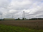
Horning
Civil parishes in NorfolkNorfolk BroadsNorth NorfolkVillages in Norfolk

Horning is an ancient village and parish in the English county of Norfolk. It covers an area of 11 km2 and had a population of 1,033 in the 2001 census. Horning parish lies on the northern bank of the River Bure south of the River Thurne and is located in The Broads National Park. For the purposes of local government, it falls within the district of North Norfolk, although areas alongside the rivers and broads fall into the executive area of the Broads Authority.
Excerpt from the Wikipedia article Horning (License: CC BY-SA 3.0, Authors, Images).Horning
Lower Street, North Norfolk
Geographical coordinates (GPS) Address Nearby Places Show on map
Geographical coordinates (GPS)
| Latitude | Longitude |
|---|---|
| N 52.7 ° | E 1.467 ° |
Address
Lower Street
Lower Street
NR12 8PF North Norfolk
England, United Kingdom
Open on Google Maps


