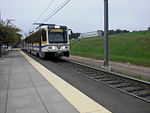
Del Paso Heights, Sacramento, California
Neighborhoods in Sacramento, California
Del Paso Heights is a neighborhood within the city of Sacramento in Sacramento County, California, United States. The generally recognized borders of Del Paso Heights consist of the Beltline Freeway Interstate 80 on the north, Norwood Avenue on the west, Arcade Creek on the south, and Roseville Road on the east. Del Paso Heights is located in Area 4 of Sacramento which is defined as the city north of the American River.
Excerpt from the Wikipedia article Del Paso Heights, Sacramento, California (License: CC BY-SA 3.0, Authors).Del Paso Heights, Sacramento, California
Presidio Street Pinell Street Alley, Sacramento
Geographical coordinates (GPS) Address Nearby Places Show on map
Geographical coordinates (GPS)
| Latitude | Longitude |
|---|---|
| N 38.636111111111 ° | E -121.42027777778 ° |
Address
Presidio Street Pinell Street Alley
Presidio Street Pinell Street Alley
95838 Sacramento
California, United States
Open on Google Maps

