Birdholme

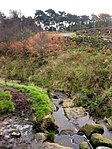
Birdholme is a suburb of the town of Chesterfield, Derbyshire, England. To its south is Wingerworth, to its north is the town centre, to its west is Boythorpe, and to its east Hasland. The large St. Augustines council estate makes up much of its area, though there are a few more affluent areas such as Langer Lane (pictured). The Bryan Donkin factory and Chesterfield Tube works (formally Tube Investments, later the TI Group) used to dominate the landscape of the area, both have now closed being replaced by new housing, Alma Leisure Park, B&Q and Toys R Us. The main Derby Road runs out of Chesterfield through Birdholme towards Clay Cross and eventually the city of Derby, which is about 25 miles away.
Excerpt from the Wikipedia article Birdholme (License: CC BY-SA 3.0, Authors, Images).Birdholme
Storforth Lane,
Geographical coordinates (GPS) Address Nearby Places Show on map
Geographical coordinates (GPS)
| Latitude | Longitude |
|---|---|
| N 53.22 ° | E -1.427 ° |
Address
Storforth Lane
Storforth Lane
S40 2TS , Spital
England, United Kingdom
Open on Google Maps


