place

Marist High School (New Jersey)

1954 establishments in New JerseyBayonne, New JerseyBuildings and structures demolished in 2022Catholic secondary schools in New JerseyDemolished buildings and structures in New Jersey
Educational institutions established in 1954Marist Brothers schoolsMiddle States Commission on Secondary SchoolsPrivate high schools in Hudson County, New JerseyRoman Catholic Archdiocese of NewarkUse American English from September 2020Use mdy dates from January 2021

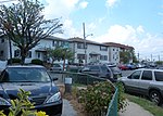
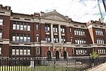
Marist High School was a private Roman Catholic co-educational college preparatory secondary school located in Bayonne, New Jersey, United States, and operated by the Marist Brothers of the Schools, an international religious congregation of educators with schools in over 70 countries. It was located within the Roman Catholic Archdiocese of Newark. The school had been accredited by the Middle States Association of Colleges and Schools Commission on Elementary and Secondary Schools since 1978.As of the 2017–18 school year, the school had an enrollment of 309 students and 24 classroom teachers (on an FTE basis), for a student–teacher ratio of 12.9:1. The school's student body was 42.4% (131) Black, 20.7% (64) Asian, 16.5% (51) White, 13.9% (43) Hispanic and 5.5% (17) two or more races.Despite plans to convert it into a middle school and sports complex, the school was demolished in 2022 due to a lack of funds for lead and asbestos remediation.

Excerpt from the Wikipedia article Marist High School (New Jersey) (License: CC BY-SA 3.0, Authors).

Marist High School (New Jersey)
Leo Slyvious Road,

Geographical coordinates (GPS) Address External links Nearby Places
placeShow on map

Wikipedia: Marist High School (New Jersey)Continue reading on Wikipedia

Geographical coordinates (GPS)

Latitude Longitude
N 40.690555555556 ° E -74.106111111111 °
placeShow on map

Address

Marist High School

Leo Slyvious Road
07002
New Jersey, United States
mapOpen on Google Maps

linkWikiData (Q6765679)
linkOpenStreetMap (357725409)

Share experience

Nearby Places

Bergen Neck
Bergen Neck

Bergen Neck is the peninsula between the Upper New York Bay and the Newark Bay in the Hudson County, New Jersey municipalities of Bayonne and Jersey City. Its southernmost tip, Bergen Point, is separated from Staten Island by the Kill van Kull, which is crossed by the Bayonne Bridge.It was likely first called so in the 17th century by the first Dutch and English speaking settlers to the region between the bays and northward along the Hudson River and Hackensack River. Though now part of Hudson County, the area was part of Bergen County from its creation in 1683 until Hudson County was created in 1840, and was part of Bergen Township, which lasted until 1862.It was first named Oyster Island by the Dutch, who at first thought it was an island, and for a brief period after the British takeover of New Netherland in 1674 was called Old Hackensack Neck. During the American Revolution British maps showed it as Barren Neck. Bergen Neck is rarely used, occasionally replaced by the terms such as Bayonne Peninsula, Hudson Peninsula, South Hudson. It gave its name to a fort during the American Revolution, which was built in 1776, occupied by the British in 1777, and demolished in September 1782. (In British hands the fort was renamed for Oliver De Lancey, Sr. as Fort Delancey.) It still lends its name to First Reformed Dutch Church of Bergen Neck in Bayonne. The waterfront of Bergen Neck varies greatly. The Central Railroad of New Jersey crossed the CRRNJ Newark Bay Bridge to its line to Communipaw Terminal, portions of which are now used by the Hudson Bergen Light Rail. The National Docks Secondary line is now used by Norfolk Southern to Port Jersey and other points. The emergence of the Hudson Palisades on Bergen Neck is called Bergen Hill, which is also traversed with rail lines.During the 20th century the east side of the peninsula was home to heavy industry, rail and shipping facilities, and military installations, notably Standard Oil, Central Railroad of New Jersey, and the Military Ocean Terminal at Bayonne. Some areas, particularly Constable Hook and Port Jersey still function in that capacity. Other brownfields have been redeveloped for residential, commercial, and recreational use, such as Liberty State Park. The west, or Newark Bay side, in Bayonne has traditionally been more residential while in Jersey City, it has tended to be more mixed-use, combining residences, retail, municipal services, manufacturing, and recreation, such as Lincoln Park.Projects to provide public access to the water's edge are in progress with the creation of Hudson River Waterfront Walkway and the Hackensack RiverWalk.

Newark Bay Bridge
Newark Bay Bridge

The Newark Bay Bridge, officially the Vincent R. Casciano Memorial Bridge, is a steel through arch bridge that is continuous across three spans. It crosses Newark Bay and connects the cities of Newark (in Essex County) and Bayonne (in Hudson County) in New Jersey, United States. It was completed April 4, 1956, as part of the New Jersey Turnpike's Newark Bay (Hudson County) Extension, with a ribbon-cutting ceremony led by Governor of New Jersey Robert B. Meyner.The main span is 1,270 feet (390 m), with a 135-foot (41 m) clearance over water to allow marine access to Port Newark. The bridge is similar in design to the Delaware River–Turnpike Toll Bridge, and is similar in length to the Francis Scott Key Bridge at Baltimore's Outer Harbor. It runs parallel to the earlier built Lehigh Valley Terminal Railway's Upper Bay Bridge. This bridge is also known as "The Turnpike Bridge" and "The Turnpike Extension Bridge". It carries traffic on a toll regulated section of Interstate 78 along the New Jersey Turnpike to interchanges 14 through 14A. It provides access from the New Jersey Turnpike's main roadway to Hudson County, New Jersey and the Holland Tunnel. The turnpike route creates the border between Bayonne and Jersey City and then runs northward along Port Jersey, Liberty State Park, and Downtown Jersey City. Hoboken is just north of the entrance to Holland Tunnel which continues to Lower Manhattan in New York City. From March 2014 until May 2019, during certain hours, the eastbound shoulder of the Turnpike Extension (including the bridge) was opened for normal traffic (by green arrows above, instead of red Xs), for a total of 5 lanes (3 eastbound, 2 westbound). This system was discontinued on May 20, 2019.There is a long-term capital improvements project to build a new bridge.