place

St Matthew's Church, Widcombe

1847 establishments in England19th-century Church of England church buildingsChurch of England church buildings in Bath and North East SomersetChurches completed in 1847Churches in Bath, Somerset
Gothic Revival architecture in SomersetGothic Revival church buildings in England
St Matthew's Church, Widcombe

St Matthew's Church in Widcombe is an Anglican church located on Cambridge Place in Widcombe, the southeastern section of Bath, Somerset. Built 1846-1847 principally to designs by Bath City Architect George Phillips Manners, it is situated above the Widcombe Locks of the Kennet and Avon Canal and opposite the Church Room Institute on Cambridge Place. It is one of two churches in the parish of Widcombe, the other being the much older St Thomas à Becket. The bells of St Matthew's were taken from St Becket's in 1847, possibly by force. The church is dismissively described by Pevsner in his Buildings of England guides as "St. Matthew, Cambridge Place, Widcombe. 1846–7 by Manners & Gill. Dull, in the Dec[orative] style, with a [south] tower carrying a broach spire."The tall spire holds 6 bells. Refurbishment during the 1970s adapted the church for use as a parish hall and provided meeting rooms and venues for various community and church events.In the summer of 2014 a newly planted congregation led by a new full-time Priest in Charge recommenced weekly worship service on Sunday evenings. A newly launched parish website covers both parish churches within Widcombe benefice and plays an active part of the wider Bath deanery.

Excerpt from the Wikipedia article St Matthew's Church, Widcombe (License: CC BY-SA 3.0, Authors, Images).

St Matthew's Church, Widcombe
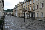
Hatfield Buildings, Bath Widcombe

Geographical coordinates (GPS) Address External links Nearby Places
placeShow on map

Wikipedia: St Matthew's Church, WidcombeContinue reading on Wikipedia

Geographical coordinates (GPS)

Latitude Longitude
N 51.376388888889 ° E -2.3519444444444 °
placeShow on map

Address

Saint Matthew's

Hatfield Buildings
BA2 6AF Bath, Widcombe
England, United Kingdom
mapOpen on Google Maps

linkWikiData (Q7594705)
linkOpenStreetMap (186129719)

St Matthew's Church, Widcombe
Share experience

Nearby Places

Bath Locks
Bath Locks

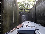
Bath Locks (grid reference ST756643) are a series of locks, now six locks, situated at the start of the Kennet and Avon Canal, at Bath, England. Bath Bottom Lock, which is numbered as No 7 on the canal, is the meeting with the River Avon just south of Pulteney Bridge. Alongside the lock is a side pond and pumping station which pumps water up the locks to replace that used each time the lock is opened.The next stage of Bath Deep Lock is numbered 8/9 as two locks were combined when the canal was restored in 1976. A road constructed while the canal was in a state of disrepair passes over the original site of the lower lock. The new chamber has a depth of 5.92 metres (19 ft 5 in), making it Britain's second deepest canal lock. Just above the 'deep lock' is an area of water enabling the lock to refill and above this is Wash House Lock (number 10), and soon after by Abbey View Lock (number 11), a Grade II listed building by which there is another pumping station and in quick succession Pulteney Lock (12) and Bath top Lock (13). Above the top lock the canal passes through Sydney Gardens where it passes through two tunnels and under two cast iron footbridges dating from 1800. Cleveland tunnel is 52.7 metres (173 ft) long and runs under Cleveland House, the former headquarters of the Kennet and Avon Canal Company. The tunnel is a Grade II* listed building.Many of the bridges over the canal are also listed buildings.The locks were restored in 1968 by a collaboration involving staff from British Waterways and volunteer labour organised by the Kennet and Avon Canal Trust.