place

Lyncombe, Bath

7th-century establishments in EnglandAreas of Bath, SomersetElectoral wards in Bath and North East SomersetJames II of EnglandMary of Modena
Populated places established in the 7th centuryUse British English from February 2012
Greenway Lane, Bath geograph.org.uk 896178

Lyncombe is a district and electoral ward in Bath, Somerset, and a former parish in the Diocese of Bath and Wells. In the mid-19th century the parish was formed when the parish of Widcombe and Lyncombe was split in two, but it was abolished in the late 1960s. The village of Lyncombe existed since at least the Saxon period prior to becoming part of the City of Bath. Lyncombe takes its name from the Celtic word cwm meaning valley, with the Lyn being the name of the stream that runs through it. The present day district is approximately centred on the Western part of this valley, known as Lyncombe Vale, and extends down to the more urban area around the River Avon across from Bath Spa railway station. The northern area of the electoral ward is known as Bear Flat.The electoral ward was merged with Widcombe at the boundary changes effected at the elections held on 2 May 2019.

Excerpt from the Wikipedia article Lyncombe, Bath (License: CC BY-SA 3.0, Authors, Images).

Lyncombe, Bath
Kipling Avenue, Bath Bear Flat

Geographical coordinates (GPS) Address Phone number Website Nearby Places
placeShow on map

Wikipedia: Lyncombe, BathContinue reading on Wikipedia

Geographical coordinates (GPS)

Latitude Longitude
N 51.373 ° E -2.3563 °
placeShow on map

Address

Beechen Cliff School

Kipling Avenue
BA2 4RE Bath, Bear Flat
England, United Kingdom
mapOpen on Google Maps

Phone number

call+441225480466

Website
beechencliff.org.uk

linkVisit website

Greenway Lane, Bath geograph.org.uk 896178
Share experience

Nearby Places

Bath Locks
Bath Locks

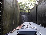
Bath Locks (grid reference ST756643) are a series of locks, now six locks, situated at the start of the Kennet and Avon Canal, at Bath, England. Bath Bottom Lock, which is numbered as No 7 on the canal, is the meeting with the River Avon just south of Pulteney Bridge. Alongside the lock is a side pond and pumping station which pumps water up the locks to replace that used each time the lock is opened.The next stage of Bath Deep Lock is numbered 8/9 as two locks were combined when the canal was restored in 1976. A road constructed while the canal was in a state of disrepair passes over the original site of the lower lock. The new chamber has a depth of 5.92 metres (19 ft 5 in), making it Britain's second deepest canal lock. Just above the 'deep lock' is an area of water enabling the lock to refill and above this is Wash House Lock (number 10), and soon after by Abbey View Lock (number 11), a Grade II listed building by which there is another pumping station and in quick succession Pulteney Lock (12) and Bath top Lock (13). Above the top lock the canal passes through Sydney Gardens where it passes through two tunnels and under two cast iron footbridges dating from 1800. Cleveland tunnel is 52.7 metres (173 ft) long and runs under Cleveland House, the former headquarters of the Kennet and Avon Canal Company. The tunnel is a Grade II* listed building.Many of the bridges over the canal are also listed buildings.The locks were restored in 1968 by a collaboration involving staff from British Waterways and volunteer labour organised by the Kennet and Avon Canal Trust.