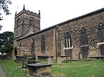
Tingley
Heavy Woollen DistrictPlaces in LeedsUse British English from September 2017Villages in West Yorkshire

Tingley is a suburban village in the City of Leeds in West Yorkshire, Northern England, forming part of the parish of West Ardsley. Tingley forms part of the Heavy Woollen District. It is situated between the cities of Leeds and Wakefield. Most of Tingley sits in the Ardsley and Robin Hood ward of Leeds City Council, whilst west Tingley forms part of Morley South ward. Both wards make up the western half of the Morley and Outwood parliamentary constituency.
Excerpt from the Wikipedia article Tingley (License: CC BY-SA 3.0, Authors, Images).Tingley
Woodkirk Grove, Leeds
Geographical coordinates (GPS) Address Nearby Places Show on map
Geographical coordinates (GPS)
| Latitude | Longitude |
|---|---|
| N 53.728 ° | E -1.584 ° |
Address
Woodkirk Grove
Woodkirk Grove
WF3 1JW Leeds
England, United Kingdom
Open on Google Maps


