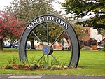
New Manchester
Geography of the Metropolitan Borough of WiganTyldesley

New Manchester or The City was an isolated mining community on the Manchester Coalfield north of Mosley Common in the Tyldesley township, England. It lies west of a boundary stone at Ellenbrook which marks the ancient boundary of the Hundreds of Salford and West Derby, the boundary of Eccles and Leigh ecclesiastical parishes, Tyldesley, Worsley and Little Hulton townships and the metropolitan districts of Wigan and Salford. The route of the Roman road from Manchester to Wigan and the Tyldesley Loopline passed south of the village. The Lancashire and Yorkshire Railway's Manchester to Southport line passed to the north.
Excerpt from the Wikipedia article New Manchester (License: CC BY-SA 3.0, Authors, Images).New Manchester
City Road,
Geographical coordinates (GPS) Address Nearby Places Show on map
Geographical coordinates (GPS)
| Latitude | Longitude |
|---|---|
| N 53.5142 ° | E -2.4192 ° |
Address
City Road
City Road
M28 1BD
England, United Kingdom
Open on Google Maps


