Ruardean
Forest of DeanUse British English from March 2015Villages in Gloucestershire

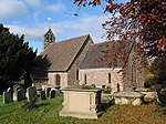
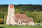
Ruardean is a village in the Forest of Dean, Gloucestershire, England, to the North West of Cinderford. It is situated on a hillside with views west towards the mountains of South Wales. Little now remains of the village's industrial history, but once it was a centre for iron-ore smelting furnaces, forges and coal mines. The Norman castle, now little more than a mound, commanded the shortest route from Gloucester Castle to the Welsh Marches and the Wye Valley.
Excerpt from the Wikipedia article Ruardean (License: CC BY-SA 3.0, Authors, Images).Ruardean
Forest of Dean Ruardean
Geographical coordinates (GPS) Address Nearby Places Show on map
Geographical coordinates (GPS)
| Latitude | Longitude |
|---|---|
| N 51.854204 ° | E -2.549622 ° |
Address
GL17 9YT Forest of Dean, Ruardean
England, United Kingdom
Open on Google Maps


