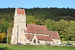
Upper Lydbrook railway station
1875 establishments in England1929 disestablishments in EnglandDisused railway stations in GloucestershirePages with no open date in Infobox stationRailway stations in Great Britain closed in 1929 ... and 3 more
Railway stations in Great Britain opened in 1875South West England railway station stubsUse British English from September 2021
Upper Lydbrook railway station served the civil parish of Lydbrook, Gloucestershire, England, from 1875 to 1929 on the Severn and Wye Railway.
Excerpt from the Wikipedia article Upper Lydbrook railway station (License: CC BY-SA 3.0, Authors).Upper Lydbrook railway station
Church Road, Forest of Dean Lydbrook
Geographical coordinates (GPS) Address Nearby Places Show on map
Geographical coordinates (GPS)
| Latitude | Longitude |
|---|---|
| N 51.8384 ° | E -2.5757 ° |
Address
Church Road
GL17 9SH Forest of Dean, Lydbrook
England, United Kingdom
Open on Google Maps


