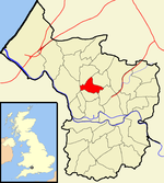
Westbury Park, Bristol
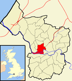
Westbury Park is a suburb of the city of Bristol, United Kingdom. It lies to the east of Durdham Down between the districts of Redland and Henleaze. The area is very similar in character to nearby Redland and comprises mainly Victorian and early twentieth-century architecture, along with a selection of Georgian buildings. Many of these buildings still have their original house names and many Victorian artifacts have been found in the gardens of Westbury Park. The area was once part of the parish of Westbury-on-Trym, from which it takes its name. Westbury Park Primary School lies in the southern side of the area and was established in 1893.Major roads within Westbury Park include North View, Coldharbour Road, Linden Road and Redland Road.
Excerpt from the Wikipedia article Westbury Park, Bristol (License: CC BY-SA 3.0, Authors).Westbury Park, Bristol
Saint Helena Road, Bristol Westbury Park
Geographical coordinates (GPS) Address Nearby Places Show on map
Geographical coordinates (GPS)
| Latitude | Longitude |
|---|---|
| N 51.4788 ° | E -2.6121 ° |
Address
Saint Helena Road 19
BS6 7NP Bristol, Westbury Park
England, United Kingdom
Open on Google Maps

