place

Cheriton Bishop

Villages in Devon
Cheriton Bishop, interior of St Mary's church geograph.org.uk 991647

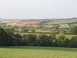
Cheriton Bishop is a village and civil parish situated on the northern borders of Dartmoor National park between Exeter and Okehampton, in Devon, England. The population at the 2011 Census was 652. The history of the settlement can be traced back over a thousand years when the old village centre was established as a commercial centre for the local farming community.

Excerpt from the Wikipedia article Cheriton Bishop (License: CC BY-SA 3.0, Authors, Images).

Cheriton Bishop
Mid Devon Cheriton Bishop

Geographical coordinates (GPS) Address Nearby Places
placeShow on map

Wikipedia: Cheriton BishopContinue reading on Wikipedia

Geographical coordinates (GPS)

Latitude Longitude
N 50.733333333333 ° E -3.7333333333333 °
placeShow on map

Address


EX6 6HD Mid Devon, Cheriton Bishop
England, United Kingdom
mapOpen on Google Maps

Cheriton Bishop, interior of St Mary's church geograph.org.uk 991647
Share experience

Nearby Places

Devon
Devon

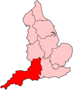
Devon ( DEV-ən, also historically known as Devonshire DEV-ən-sheer, -⁠shər) is a ceremonial, non-metropolitan, and historic county in South West England. Devon is coastal with a variety of cliffs and sandy beaches. It has the largest open space in southern England, Dartmoor National Park. A predominately rural county, Devon has a relatively low population density for a county in England. Its most populous settlement is the City of Plymouth. The county town of Devon, the City of Exeter, is the second most populous settlement. The county is bordered by Somerset to the north east, Dorset to the east, and Cornwall to the west. Its economy is heavily orientated around the tourism and agriculture industries. Devon is administratively split into the non-metropolitan districts of East Devon, Mid Devon, North Devon, South Hams, Teignbridge, Torridge, West Devon, Exeter, and two unitary authority areas of Plymouth, and Torbay. Combined as a ceremonial county, Devon's area is 6,707 km2 (2,590 square miles) and its population is about 1.2 million. The county derives its name from Dumnonia (the shift from m to v is a typical Celtic consonant shift). During the British Iron Age, Roman Britain and the early Middle Ages, this was the homeland of the Dumnonii Brittonic Celts. The Anglo-Saxon settlement of Britain resulted in the partial assimilation of Dumnonia into the Kingdom of Wessex during the eighth and ninth centuries. The western boundary with Cornwall was set at the River Tamar by King Æthelstan in 936. Devon was later constituted as a shire of the Kingdom of England.

River Yeo (tributary of the Creedy)

The River Yeo is a tributary to the River Creedy. It is located in Devon, England, and its headwaters float within two miles of a different River Yeo, which is a tributary to River Taw. It is a popular location for fly fishing, with the Crediton Fly Fishing Club owning a small portion of it.Tributaries of the River Yeo include River Culvery which joins just south of Crediton, Ford Brook which joins at Neopardy, and River Troney which joins at Yeoford. The source of the river is near Merrymeet Junction on the A30 Road at Whiddon Down. Since January 1997, a flood gauge at Yeoford measures the river height, which is normally below 0.66 metres (2 ft 2 in). The site base level is 60.58 metres (198.8 ft) The highest recorded level is 2.69 metres (8 ft 10 in) on 25 November 2012.South of Crediton the River Yeo forms part of the boundary between Crediton Civil Parish and Crediton Hamlets Civil Parish. Southwest of Yeoford the River Yeo forms the boundary between Colebrook Civil Parish and Crediton Hamlets Civil Parish. Further to the southwest it forms the boundary between Hittisleigh CP and Cheriton Bishop CP.Places along the river include Downs Crediton Golf Club, Fordton Mill, Salmonhutch, Salmonhutch Caravan Park, Beare Mill, Neopardy, Yeoford, Martin's Moor Copse, Wotton's Moor Copse, Binneford, Binneford Wood, Parlepit Copse, Furzeyew Copse, Vennals Copse, Milball Copse, Ball Copse, and Treable Woods.