place

West Country English

Dialects of languages with ISO 639-3 codeEnglish language in EnglandLanguages of the United KingdomUse British English from December 2014West Country
EnglandSouthWest
EnglandSouthWest

West Country English is a group of English language varieties and accents used by much of the native population of South West England, the area sometimes popularly known as the West Country.The West Country is often defined as encompassing the counties of Cornwall, Devon, Dorset, Somerset, Wiltshire, the City of Bristol, and Gloucestershire. However, the northern and eastern boundaries of the area are hard to define. In the adjacent counties of Herefordshire, Worcestershire, Hampshire and Oxfordshire it is possible to encounter similar accents and, indeed, much the same distinct dialect but with some similarities to others in neighbouring regions. Although natives of such locations, especially in rural parts, can still have West Country influences in their speech, the increased mobility and urbanisation of the population has meant that in the more populous of those counties the dialect itself, as opposed to various local accents, is becoming increasingly rare. Academically the regional variations are considered to be dialectal forms. The Survey of English Dialects captured manners of speech across the South West region that were just as different from Standard English as any from the far North of England. There is some influence from the Welsh and Cornish languages depending on the specific location.

Excerpt from the Wikipedia article West Country English (License: CC BY-SA 3.0, Authors, Images).

West Country English
Teignbridge Tedburn St. Mary

Geographical coordinates (GPS) Address Nearby Places
placeShow on map

Wikipedia: West Country EnglishContinue reading on Wikipedia

Geographical coordinates (GPS)

Latitude Longitude
N 50.716666666667 ° E -3.7166666666667 °
placeShow on map

Address


EX6 7AJ Teignbridge, Tedburn St. Mary
England, United Kingdom
mapOpen on Google Maps

EnglandSouthWest
EnglandSouthWest
Share experience

Nearby Places

Devon
Devon

Devon ( DEV-ən, also historically known as Devonshire DEV-ən-sheer, -⁠shər) is a ceremonial, non-metropolitan, and historic county in South West England. Devon is coastal with a variety of cliffs and sandy beaches. It has the largest open space in southern England, Dartmoor National Park. A predominately rural county, Devon has a relatively low population density for a county in England. Its most populous settlement is the City of Plymouth. The county town of Devon, the City of Exeter, is the second most populous settlement. The county is bordered by Somerset to the north east, Dorset to the east, and Cornwall to the west. Its economy is heavily orientated around the tourism and agriculture industries. Devon is administratively split into the non-metropolitan districts of East Devon, Mid Devon, North Devon, South Hams, Teignbridge, Torridge, West Devon, Exeter, and two unitary authority areas of Plymouth, and Torbay. Combined as a ceremonial county, Devon's area is 6,707 km2 (2,590 square miles) and its population is about 1.2 million. The county derives its name from Dumnonia (the shift from m to v is a typical Celtic consonant shift). During the British Iron Age, Roman Britain and the early Middle Ages, this was the homeland of the Dumnonii Brittonic Celts. The Anglo-Saxon settlement of Britain resulted in the partial assimilation of Dumnonia into the Kingdom of Wessex during the eighth and ninth centuries. The western boundary with Cornwall was set at the River Tamar by King Æthelstan in 936. Devon was later constituted as a shire of the Kingdom of England.

Dunsford
Dunsford

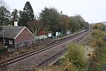
Dunsford is a village in Devon, England, just inside the Dartmoor National Park. The place-name 'Dunsford' is first attested in the Domesday Book of 1086, where it appears as Dunesforda, meaning 'Dunn's ford'.The village has a number of traditional thatched cottages; a primary school which has a swimming pool, climbing wall and sports field; one village shop and post office; a tea room and a public house. St Mary's Church, built between 1420 and 1455, is located in the village centre. Dunsford holds a village show at the beginning of July every year and the Dunsford Amateur Dramatic Society (DADS) produces a pantomime in the Village Hall in early January. The villagers also hold an annual fancy dress pancake race in the streets. Dunsford Halt was a station on the Teign Valley Line from Exeter to Heathfield station that served the village from 1928 to 1958. Great Fulford House lies to the west of Dunsford; a Domesday manor which has been the home of the Fulford family since at least 1190. The present house was mainly built in the early 16th century and is a semi-fortified mansion house built round a central courtyard. It was the backdrop to the 2014 reality-television programme, Life Is Toff. Nearby is Dunsford Woods nature reserve which is managed by Devon Wildlife Trust and consists of 57 hectares of river valley woodland, heath-covered rocky slopes and fertile flood-plain scrub and grassland. It is especially known for its wild daffodils and six species of fritillary butterfly. The hamlet of Butts is about one mile west of Dunsford, and generally considered to be part of the village, as is "Reedy," a similar distance to the East.

River Yeo (tributary of the Creedy)

The River Yeo is a tributary to the River Creedy. It is located in Devon, England, and its headwaters float within two miles of a different River Yeo, which is a tributary to River Taw. It is a popular location for fly fishing, with the Crediton Fly Fishing Club owning a small portion of it.Tributaries of the River Yeo include River Culvery which joins just south of Crediton, Ford Brook which joins at Neopardy, and River Troney which joins at Yeoford. The source of the river is near Merrymeet Junction on the A30 Road at Whiddon Down. Since January 1997, a flood gauge at Yeoford measures the river height, which is normally below 0.66 metres (2 ft 2 in). The site base level is 60.58 metres (198.8 ft) The highest recorded level is 2.69 metres (8 ft 10 in) on 25 November 2012.South of Crediton the River Yeo forms part of the boundary between Crediton Civil Parish and Crediton Hamlets Civil Parish. Southwest of Yeoford the River Yeo forms the boundary between Colebrook Civil Parish and Crediton Hamlets Civil Parish. Further to the southwest it forms the boundary between Hittisleigh CP and Cheriton Bishop CP.Places along the river include Downs Crediton Golf Club, Fordton Mill, Salmonhutch, Salmonhutch Caravan Park, Beare Mill, Neopardy, Yeoford, Martin's Moor Copse, Wotton's Moor Copse, Binneford, Binneford Wood, Parlepit Copse, Furzeyew Copse, Vennals Copse, Milball Copse, Ball Copse, and Treable Woods.