Waimakariri River

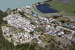
The Waimakariri River is one of the largest rivers in Canterbury, on the eastern coast of New Zealand's South Island. It flows for 151 kilometres (94 mi) in a generally southeastward direction from the Southern Alps across the Canterbury Plains to the Pacific Ocean. The river rises on the eastern flanks of the Southern Alps, eight kilometres southwest of Arthur's Pass. For much of its upper reaches, the river is braided, with wide shingle beds. As the river approaches the Canterbury Plains, it passes through a belt of mountains, and is forced into a narrow canyon (the Waimakariri Gorge), before reverting to its braided form for its passage across the plains. It enters the Pacific north of Christchurch, near the town of Kaiapoi. Instead of being unoccupied Crown land as are most New Zealand river beds, the bed of the Waimakariri River is vested in the Canterbury Regional Council (Environment Canterbury).
Excerpt from the Wikipedia article Waimakariri River (License: CC BY-SA 3.0, Authors, Images).Waimakariri River
Waimakari Spit (orange track), Christchurch Brooklands (Coastal-Burwood Community)
Geographical coordinates (GPS) Address Nearby Places Show on map
 Continue reading on Wikipedia
 Geographical coordinates (GPS)
| Latitude | Longitude |
|---|---|
| N -43.390555555556 ° | E 172.70805555556 ° |
Address
Waimakari Spit (orange track)
Waimakari Spit (orange track)
Christchurch, Brooklands (Coastal-Burwood Community)
Canterbury, New Zealand
Open on Google Maps