place

La Jolla, Placentia, California

Neighborhoods in Orange County, CaliforniaPlacentia, California

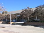
La Jolla is a small neighborhood in Placentia, California, in northern Orange County. Traditionally La Jolla has largely been made up of Hispanics, but does have Caucasian and a small portion of other races. This small neighborhood was once known as La Jolla Colony, Placentia and was not considered part of unincorporated Anaheim. Today, like the nearby community of Atwood, La Jolla is part of the City of Placentia. Since its construction, La Jolla has been bisected by the 57 Freeway, but connected by a traffic and pedestrian bridge over the freeway. La Jolla was severely damaged in the Orange County flood of 1938 which destroyed almost every structure in the area with the exception of McFadden School, a small church, and about 7 blocks of homes. La Jolla is primarily a residential area made up of older single-family homes and several apartment complexes. La Jolla does not have many businesses except for a couple of small independent neighborhood markets. The three main stores in the area are the Urdiano's Market on West La Jolla Street, Gonzales Market on the east side of the 57 freeway, and Pee Wee's Market on the west side. The Gonzales Market is believed to have been constructed shortly after the Orange County flood of 1936. Pee Wee's Market was opened around 1960 by the Magaña family, long-time residents of Placentia. The corner of La Jolla Street and Melrose at the east end of the La Jolla Neighborhood was once the site of McFadden Elementary School. The School was torn down in the early 1980s, but recently a new school was built. The new school is known as Melrose Elementary School and the attached park is still known as McFadden Park. Brent Liles, former bassist for Social Distortion, died on January 18, 2007, in La Jolla. He was struck by a truck as he rode his bicycle across a street.

Excerpt from the Wikipedia article La Jolla, Placentia, California (License: CC BY-SA 3.0, Authors).

La Jolla, Placentia, California
West la Jolla Street,

Geographical coordinates (GPS) Address Nearby Places
placeShow on map

Wikipedia: La Jolla, Placentia, CaliforniaContinue reading on Wikipedia

Geographical coordinates (GPS)

Latitude Longitude
N 33.8575151 ° E -117.8764474 °
placeShow on map

Address

West la Jolla Street

West la Jolla Street
92870
California, United States
mapOpen on Google Maps

Share experience

Nearby Places

Anaheim, California
Anaheim, California

Anaheim ( AN-ə-hyme) is a city in northern Orange County, California, part of the Los Angeles metropolitan area. As of the 2020 United States Census, the city had a population of 346,824, making it the most populous city in Orange County, the 10th-most populous city in California, and the 55th-most populous city in the United States. Anaheim is the second-largest city in Orange County in terms of land area, and is known for being the home of the Disneyland Resort, the Anaheim Convention Center, and two major sports teams: the Los Angeles Angels baseball team and the Anaheim Ducks ice hockey club. Anaheim was founded by fifty German families in 1857 and incorporated as the second city in Los Angeles County on March 18, 1876; Orange County was split off from Los Angeles County in 1889. Anaheim remained largely an agricultural community until Disneyland opened on July 17, 1955. This led to the construction of several hotels and motels around the area, and residential districts in Anaheim soon followed. The city also developed into an industrial center, producing electronics, aircraft parts and canned fruit. Anaheim is a charter city.Anaheim's city limits extend almost the full width of Orange County, from Cypress in the west, twenty miles east to the Riverside County line, encompassing a diverse range of neighborhoods. In the west, mid-20th-century tract houses predominate. Downtown Anaheim has three mixed-use historic districts, the largest of which is the Anaheim Colony. South of downtown, a center of commercial activity of regional importance begins, the Anaheim–Santa Ana edge city, which stretches east and south into the cities of Orange, Santa Ana and Garden Grove. This edge city includes the Disneyland Resort, with two theme parks, multiple hotels, and its retail district; Disney is part of the larger Anaheim Resort district with numerous other hotels and retail complexes. The Platinum Triangle, a neo-urban redevelopment district surrounding Angel Stadium, which is planned to be populated with mixed-use streets and high-rises. Further east, Anaheim Canyon is an industrial district north of the Riverside Freeway and east of the Orange Freeway. The city's eastern third consists of Anaheim Hills, a community built to a master plan, and open land east of the Route 241 tollway.