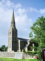
Skirden Beck
England river stubsLancashire geography stubsRibble catchmentRivers of LancashireRivers of Ribble Valley

Skirden Beck is a minor river in Lancashire, England (historically in the West Riding of Yorkshire). It is approximately 4.3 miles (6.85 km) long and has a catchment area of 18.87 square miles (48.882 km2).The Beck is formed at the confluence of New Gill Beck and Grunsagill Beck and flows southward, being joined by Grainings Clough and then Monubent Beck (at Forest Becks near Skirden). After passing through Bolton-by-Bowland village it collects Bier Beck and Kirk Beck, before passing Bolton Mill. The confluence with Holden Beck occurs just before Skirden Beck falls into the River Ribble near Briery Bank Wood.
Excerpt from the Wikipedia article Skirden Beck (License: CC BY-SA 3.0, Authors, Images).Skirden Beck
Ribble Valley Bolton-by-Bowland
Geographical coordinates (GPS) Address Nearby Places Show on map
Geographical coordinates (GPS)
| Latitude | Longitude |
|---|---|
| N 53.9254 ° | E -2.3349 ° |
Address
Bolton-by-Bowland
Ribble Valley, Bolton-by-Bowland
England, United Kingdom
Open on Google Maps
