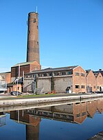
Baker Way
Footpaths in CheshireUse British English from April 2017

The Baker Way is a footpath running from Chester railway station to Delamere railway station within the English county of Cheshire. The total length of the trail is 13 miles (21 km). Its name commemorates the life and work of Jack Baker, a former footpaths officer for Cheshire County Council.
Excerpt from the Wikipedia article Baker Way (License: CC BY-SA 3.0, Authors, Images).Baker Way
Kelsall Road,
Geographical coordinates (GPS) Address Nearby Places Show on map
Geographical coordinates (GPS)
| Latitude | Longitude |
|---|---|
| N 53.1968 ° | E -2.8798 ° |
Address
Cheshire Brick and Slate
Kelsall Road
CH3 8NR , Tarvin
England, United Kingdom
Open on Google Maps


