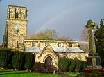
Thringstone

Thringstone is a village in the North West Leicestershire district, in Leicestershire, England. About 3 miles (4.8 km) north of Coalville, it lies in the English National Forest.Until 1875, Thringstone had been a township within the ancient parish of Whitwick. The township of Thringstone, based on a feudal (manorial) division of land carved out during the Anglo-Saxon period, comprised Thringstone village (then known as South Thringstone) and the hamlets of Peggs Green and Rotten Row in an area known as North Thringstone. Thringstone became an independent and autonomous civil parish in 1866, though this was dissolved on 1 April 1936 when outlying parts of the parish were transferred to Belton, Coleorton, Osgathorpe, Swannington and Worthington and the remainder was transferred to the civil parish and Urban District of Coalville. In 1931 the parish had a population of 1,566. The geographical area known as Thringstone today bears little resemblance to that known as Thringstone before World War II. In 2023, Thringstone is not part of a civil parish.
Excerpt from the Wikipedia article Thringstone (License: CC BY-SA 3.0, Authors, Images).Thringstone
Loughborough Road, North West Leicestershire
Geographical coordinates (GPS) Address Nearby Places Show on map
Geographical coordinates (GPS)
| Latitude | Longitude |
|---|---|
| N 52.75571 ° | E -1.36573 ° |
Address
Loughborough Road 120
LE67 8LQ North West Leicestershire
England, United Kingdom
Open on Google Maps


