place

Whitwick

Civil parishes in LeicestershireIncomplete lists from February 2023North West Leicestershire DistrictUse British English from July 2015Villages in Leicestershire
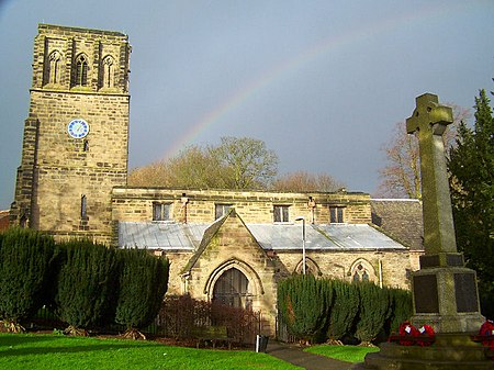
Whitwick parish church

Whitwick is a village and civil parish in the North West Leicestershire district of Leicestershire, England, close to the town of Coalville in the northwest of the county. It lies in an ancient parish which formerly included the equally historic villages of Thringstone and Swannington. It was an important manor in the Middle Ages, which once included Bardon and Markfield, parts of Hugglescote, Donington le Heath, Ratby, Bocheston, Newtown Unthank and Whittington. As early as 1293, Whitwick had a weekly market and a four-day fair. The population of Whitwick, according to the 2001 census was 10,815 persons. 8,092 of these fell into the 16–74 working age range, although only 4,689 were employed. The population of the village at the 2011 census had fallen to 8,612.

Excerpt from the Wikipedia article Whitwick (License: CC BY-SA 3.0, Authors, Images).

Whitwick
Market Place, North West Leicestershire

Geographical coordinates (GPS) Address Nearby Places
placeShow on map

Wikipedia: WhitwickContinue reading on Wikipedia

Geographical coordinates (GPS)

Latitude Longitude
N 52.740277777778 ° E -1.3555555555556 °
placeShow on map

Address

J Wong

Market Place 6
LE67 5DT North West Leicestershire
England, United Kingdom
mapOpen on Google Maps

Whitwick parish church
Share experience

Nearby Places

Coalville Meadows
Coalville Meadows

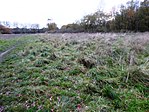
Coalville Meadows is a 6.0 hectares (15 acres) biological Site of Special Scientific Interest between Whitwick and Coalville in Leicestershire. It is managed by the Friends of Holly Hayes Wood.It is one of the best examples of neutral grassland that has developed on the somewhat leached clay soils of Leicestershire and is representative of such grassland in Central and Eastern England. It is bounded on the West by a former minerals railway line, to the South by social housing, the east by Holly Hayes Woodland, and to the North by an aggregate storage area, and have developed on soils derived from the clays of the Triassic Keuper Marl. The grassland is poorly drained and is dominated by tufted hair-grass Deschampsia caespitosa, Yorkshire fog Holcus lanatus, red fescue Festuca rubra and great burnet Sanguisorba officinalis. Additionally, flora typical of relatively base-poor clay soils, such as pignut Conopodium majus, betony Betonica officinalis, heath bedstraw Galium saxatile, tormentil Potentilla erecta, devil's-bit scabious Succisa pratensis, and mat grass Nardus stricta, are present. The grassland also includes typical meadow species as saw-wort Serratula tinctoria, meadow thistle Cirsium dissectum, knapweed Centaurea nigra and lady's smock Cardamine pratensis. In 2008, the site was bought by the Friends of Holly Hayes Wood who wanted to see the meadow land restored to its former glory. The group is working with Natural England to re-establish appropriate maintenance which it hoped will lead to a more appropriate 'favourable' status and to ensure that the meadow is meeting its conservation objectives. There is access to the site from the Ivanhoe Way footpath.