Stanthorne
Cheshire West and ChesterFormer civil parishes in CheshireUse British English from July 2016Villages in Cheshire

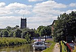
Stanthorne is a village in Cheshire, England, 2 miles west of Middlewich. The A54 runs through the village, connecting it to the railway station at Winsford. At the 2011 census, it had a population of 153.In 2015, the civil parish amalgamated with Wimboldsley to form Stanthorne and Wimboldsley.
Excerpt from the Wikipedia article Stanthorne (License: CC BY-SA 3.0, Authors, Images).Stanthorne
Coalpit Lane,
Geographical coordinates (GPS) Address Nearby Places Show on map
Geographical coordinates (GPS)
| Latitude | Longitude |
|---|---|
| N 53.19 ° | E -2.466 ° |
Address
Coalpit Lane
Coalpit Lane
CW10 9JS , Stanthorne and Wimboldsley
England, United Kingdom
Open on Google Maps


