place

Drakens Gränd

Stockholm road stubsStreets in Stockholm
Drakens Gränd Gamla Stan Stockholm 2019 08 13

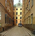
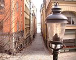
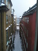
Drakens Gränd is an alley in Gamla stan, the old town of Stockholm, Sweden. Stretching from Skeppsbron to Österlånggatan, it forms a parallel street to Stora Hoparegränd and Ferkens Gränd. It appears in historical records as Bredgränd (?), brede gränden (?), Makelerens gränd (17th century, after a Jacob Mac Leer), Bergsgränd (1686), Drakens gr[änd] (1728), Skultans gränd (?)The alley is named after the tavern Draken ("The Dragon") once found in the western end of the street. During the 1660s it was owned by a Melchior Schipman; in 1682 bought by Jöran Berg and renamed Förgyllda Draken ("Gilded Dragon"); and finally discontinued after the latter's death in 1722.The proletarian author Erik Asklund (1908–1980) wrote the novel Drakens gränd in 1965 as part of a trilogy.Drakens gränd is also the name of a company owned by King Carl XVI Gustav (1946-). The company appeared in Swedish media in early 2006, as a property in the alley owned by the king featured in transactions for which the king was accused of tax avoidance.

Excerpt from the Wikipedia article Drakens Gränd (License: CC BY-SA 3.0, Authors, Images).

Drakens Gränd
Drakens Gränd, Stockholm Gamla stan (Södermalms stadsdelsområde)

Geographical coordinates (GPS) Address External links Nearby Places
placeShow on map

Wikipedia: Drakens GrändContinue reading on Wikipedia

Geographical coordinates (GPS)

Latitude Longitude
N 59.324444444444 ° E 18.07475 °
placeShow on map

Address

Drakens Gränd

Drakens Gränd
111 31 Stockholm, Gamla stan (Södermalms stadsdelsområde)
Sweden
mapOpen on Google Maps

linkWikiData (Q5305649)
linkOpenStreetMap (1881743)

Drakens Gränd Gamla Stan Stockholm 2019 08 13
Share experience

Nearby Places

Pelikansgränd
Pelikansgränd

Pelikansgränd is an alley in Gamla stan, the old town of Stockholm, Sweden, connecting Gaffelgränd to Österlånggatan. It forms a parallel street to Ferkens Gränd, Lilla Hoparegränd, Gaffelgränd, and Johannesgränd. The alley appears in historical records as Lilla S:t Johannes gränd in 1664, Pilicans Gränden around 1700, and Pelekans gr[änd] in 1733. In the basement of the building still present on 39, Österlånggatan, constructed by a man named Hans Georg Cron who bought the site in 1664, was an inn called Pelikan ("Pelican"), an establishment which gave its name to both the building and the street. A noteworthy portal of historical interest is found on number 3.Like most of the structures along the eastern waterfront, the buildings in the alley were built on garbage and landfills, and, as unveiled in connection with excavations in the 1940s and 1950s, 5–6 metres long poles pushed vertically through the layers during the 15th century, are today leaning some 20 degrees towards the water, thus indicating the area have been sliding eastward by some 2–3 metres and sinking by at least 1.5 metres.The oldest archaeological traces underlying the area are the remains of a landing stage found close to today's Österlånggatan, revealing that it was first settled in the late-13th and early-14th centuries. The oldest historical evidence mentions two stone houses on Österlånggatan flanking an alley leading down to a bulwark by the water demolished in 1430. The location of the bulwark can still be seen at the border between the properties south of the alley.An archaeological investigation in 1997–1998, showed the storehouse on number 1 dates from 1700, and the building east of it probably from the same period.

Fisketorget

Fisketorget (Swedish: "Fishery Square") or Fiskaretorget ("Fishermen's Square") is a historical public square in Gamla stan, the old town in central Stockholm, Sweden. It was once located on the east shore of the island Stadsholmen, between the present streets Österlånggatan and Skeppsbron, and between the present alleys Nygränd ("New Alley") and Brunnsgränd ("Well's Alley"). As Stockholm grew rapidly during the 14th century, the city within the city walls became cramped for space, and the surrounding shores started to be built upon and subsequently by land fillings between the bridges extended into the water. Thus, elongated blocks appeared between narrow alleys along the eastern shore of the city, with the exception of the area outside the only eastern city gate — the so-called Köpmanporten ("Merchant's Gate") which extended Köpmangatan ("Merchant's Street) from the city's central square, Stortorget ("Large Square"), beyond the city wall over Köpmanbrinken. Originally, the marketplace was called Fiskestrand ("Fishery Shore") and also encompassed a section of the shoreline stretching north up to the present alley Skeppar Karls Gränd.From 1413, the square was probably flanked by two defensive towers, some major building featuring stepped gables, and several one-storey buildings. In 1461, a blacksmith named Henrik is mentioned as having forged on a water well on the square, at the time the biggest in Stockholm. The well eventually gave the southern alley its name and was still found in the alley until the 19th century. The square was, however, was started to be built upon during the early 1520s, which eventually led to the present block on the location, Diana, which still contains the well.