place

Fort Eustis Military Railroad

Industrial railroads in the United StatesMilitary installations in VirginiaMilitary logistics of the United StatesMilitary railwaysTransportation in Newport News, Virginia
United States Army locomotivesUnited States Army logistics installationsUse mdy dates from January 2020Vague or ambiguous time from September 2017
USAX 4635 GP16
USAX 4635 GP16

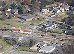
The Fort Eustis Military Railroad is an intra-plant United States Army rail transportation system existing entirely within the post boundaries of the United States Army Transportation Center and Fort Eustis (USATCFE), Fort Eustis, Virginia. It has served to provide railroad operation and maintenance training to the US Army and to carry out selected material movement missions both within the post and in interchange with the US national railroad system via a junction at Lee Hall, Virginia. It consists of 31 miles (50 km) of track broken into three subdivisions with numerous sidings, spurs, stations and facilities. This article concentrates on the height of US Army rail operations on the Fort Eustis Military Railroad from the late 1950s to the mid-1960s prior to divestiture of the rail operations and maintenance missions in the 1970s when they were turned over to civil servants and later to contractors, and the rail training mission transferred to the 84th Training Command. The Utility Rail Branch (URB) of the Fort Eustis Military Railway continues to operate today under the command of the 733RD Logistics Readiness Division (LRD), Joint-Base Langley Eustis. The Utility Rail Branch of the Fort Eustis Military Railroad joined Operation Lifesaver in 2010.

Excerpt from the Wikipedia article Fort Eustis Military Railroad (License: CC BY-SA 3.0, Authors, Images).

Fort Eustis Military Railroad
Taylor Avenue,

Geographical coordinates (GPS) Address Nearby Places
placeShow on map

Wikipedia: Fort Eustis Military RailroadContinue reading on Wikipedia

Geographical coordinates (GPS)

Latitude Longitude
N 37.1569 ° E -76.597 °
placeShow on map

Address

Hanks Yard

Taylor Avenue
23604
Virginia, United States
mapOpen on Google Maps

USAX 4635 GP16
USAX 4635 GP16
Share experience

Nearby Places

Fort Crafford
Fort Crafford

Fort Crafford is a historic archaeological site located at Fort Eustis, Newport News, Virginia. It is a pentagonal-shaped earthwork located on Mulberry Island and built by Confederate forces in 1862. The earthworks on Mulberry Island are considered part of the Warwick Line. The purpose of these works was to prevent the Union from flanking the line on the James River. The fort formed the James River terminus of the second trans-peninsula defensive line, which included fortifications at Lee's Mill, as well as Dam No.1 and Wynne's Mill in Newport News Park. Mulberry Point Battery, a water battery, guarded the Swash Channel along the James River. This battery was a complement to Fort Huger on the south side of the river. In February 1862 a pentagonal earthwork enclosing approximately eight acres was constructed inland from the Mulberry Point Battery to protect the battery from overland attack and to be a refuge for soldiers if the Minor Farm Line (a short rifle line constructed to defend the rear of the battery) was overrun. The fort was called the "covering work at Mulberry Island," or Mulberry Island Fort; later it became known as Fort Crafford after the owners of the land where it was built. This fort was not intended to be part of the main Warwick Line, but was separated from it by about half a mile so that troops could withdraw from the line into the fort if necessary. Confederate forces withdrew from Mulberry Island in May 1862 to move closer to Richmond, so Fort Crafford never saw combat.The foundation of the Crafford house located within the earthwork was excavated in the 1970s by amateur archaeologists of the Fort Eustis Historical and Archaeological Association. The brick and oyster-shell mortar foundation of the house remains, surrounded by a protective fence.In 1998 archaeologists from the Colonial Williamsburg Department of Archaeological Research conducted investigations into a seventeenth-century occupation of the area within the Civil War fortification. Three areas of seventeenth-century domestic activity were identified.Fort Crafford was listed on the National Register of Historic Places in 1974.

Lee's Mill Earthworks

Lee's Mill Earthworks is a historic archaeological site located at Newport News, Virginia. The earthworks formed part of the fortifications along the James River, which included fortifications at Fort Crafford, as well as, Dam No.1, and Wynne's Mill in Newport News Park. On April 5, 1862, advance units of Union Brigadier General Erasmus D. Keyes' IV Corps, under the command of Union Brigadier General William Farrar Smith, encountered Confederate units commanded by Brigadier General Lafayette McLaws at Lee's Mill. Heavy rains and massive earthen fortifications defending the river crossing stopped the Union troops from proceeding to Richmond. Confederate Major General John B. Magruder's extensive defensives beginning at Lee's Mill and extending to Yorktown along the Warwick River caused the Union Army of the Potomac Commander Major General George B. McClellan to initiate a month-long siege of the Warwick-Yorktown Line which lasted until May 3, 1862 and contributed to the eventual failure of McClellan's campaign.Lee's Mill has recently been preserved and is being transformed into a passive park with trails interpreting the fortifications. The earthen fortifications remain visible in many locations, including Newport News Park and the Lee's Mill subdivision. An active effort will be made to delineate, preserve and interpret these earthworks for the future.It was listed on the National Register of Historic Places in 2003.