place

Angeles National Forest

1908 establishments in CaliforniaAngeles National ForestCalifornia Historical LandmarksNational Forests of CaliforniaParks in Los Angeles County, California
Parks in Southern CaliforniaProtected areas established in 1908Protected areas of Los Angeles County, CaliforniaProtected areas of Southern CaliforniaProtected areas of the Mojave DesertSan Gabriel MountainsSierra Pelona RidgeTourist attractions in Los Angeles County, CaliforniaUse mdy dates from February 2022
Angelesnationalforest

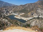
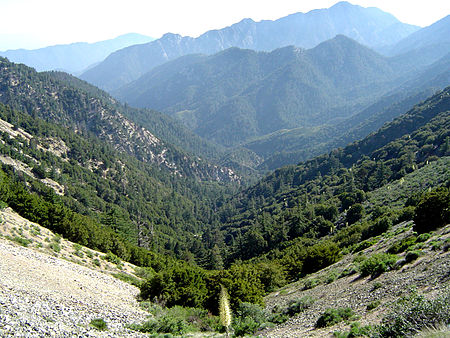
The Angeles National Forest (ANF) of the U.S. Forest Service is located in the San Gabriel Mountains and Sierra Pelona Mountains, primarily within Los Angeles County in southern California. The ANF manages a majority of the San Gabriel Mountains National Monument. The national forest was established in 1908, incorporating the first San Bernardino National Forest and parts of the former Santa Barbara and San Gabriel National Forests. Angeles National Forest headquarters are located in Arcadia, California.

Excerpt from the Wikipedia article Angeles National Forest (License: CC BY-SA 3.0, Authors, Images).

Angeles National Forest

Geographical coordinates (GPS) Address Nearby Places
placeShow on map

Wikipedia: Angeles National ForestContinue reading on Wikipedia

Geographical coordinates (GPS)

Latitude Longitude
N 34.333333333333 ° E -118.13333333333 °
placeShow on map

Address

Singing Springs


California, United States
mapOpen on Google Maps

Angelesnationalforest
Share experience

Nearby Places

Mount Lowe (California)

Mount Lowe is a mountain on the southern fold of the San Gabriel Mountains. Originally named Oak Mountain, it was renamed for Professor Thaddeus S.C. Lowe, who is credited for being the first person to set foot on and plant the American flag at its peak, and who built the Mount Lowe Railway to its foot in 1896. The record of the naming was made official by Andrew McNally, the famous Chicago map printer and summertime resident of Altadena, who promised to print "Mount Lowe" on all his maps. Mt. Lowe was established as an alternate route for the Mount Lowe Railway when attempts to procure rights of way to the more prominent Mount Wilson had failed. A number of trails stem from it due to the Mount Lowe Tavern which was built at Crystal Springs below the summit and operated from 1895 to 1936. One of the historic trails was the "Mount Lowe Eight" which was a mule ride attraction of the hotel that made a figure eight shaped route starting at the Tavern, ascending the summit of Mt. Lowe, returning to the Tavern, and crisscrossing to a trail that headed down Castle Canyon. From there the trail passed down to the Echo Mountain resort and ascended on the return to the Tavern. Mount Lowe was the upper terminus of the Alpine Division of the Mount Lowe Railway originally incorporated by Professor Lowe as the Pasadena and Mt. Wilson Railroad Co.Mt. Lowe is approachable from Echo Mountain or Chaney trail via a fire road which was graded over the old railway right-of-way.